10-Day Weather Forecast - Montrose, MN
- |29°FPartly CloudyHourly details
Tonight
29°FPartly cloudy. Low temperature around 29F. Dew point will be around 30F with an average humidity of 96%. Winds will be 6 mph from the SE.
Weekend Weather
- 42|34°FCloudyHourly details
Day
42°FCloudy. Areas of dense freezing fog early in the morning. Areas of dense fog early in the morning then patchy fog in the afternoon. Highs in the lower 40s. South winds 5 to 10 mph.
Night
34°FCloudy. Patchy fog through the night. A 50 percent chance of rain and light freezing drizzle after midnight. Lows around 20. Temperatures rising into the mid 30s after midnight. Southeast winds up to 5 mph shifting to the north after midnight.
- 33|8°FFreezing DrizzleHourly details
Day
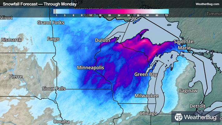
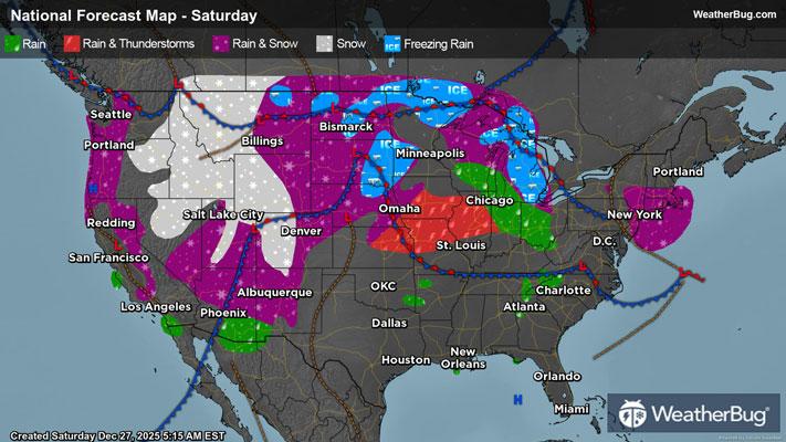
33°FBreezy colder. Snow likely and chance of light freezing drizzle in the morning then snow in the afternoon. Patchy blowing snow in the morning then areas of blowing snow in the afternoon. Snow accumulation of 4 to 5 inches. Highs in the lower 30s. Temperatures falling into the lower teens in the afternoon. Northwest winds 15 to 25 mph. Gusts up to 40 mph in the afternoon. Chance of precipitation 90 percent.
Night
8°FWindy colder. Snow likely in the evening then chance of snow after midnight. Areas of blowing snow in the evening then patchy blowing snow after midnight. Moderate snow accumulations. Lows around 4. Northwest winds 20 to 30 mph. Chance of snow 70 percent.
- 8|2°FSnowHourly details
Day
8°FBreezy. Much colder. Partly sunny in the morning then clearing. Patchy blowing snow in the morning. Highs around 9. Northwest winds 15 to 25 mph.
Night
2°FMostly clear. Lows near zero.
- 29|14°FMostly CloudyHourly details
Day
29°FNot as cold. Mostly cloudy. Highs in the upper 20s.
Night
14°FMostly cloudy. Lows around 9.
- 13|-2°FMostly CloudyHourly details
Day
13°FColder. Mostly cloudy. Highs around 14.
Night
-2°FColder. Mostly cloudy in the evening then clearing. Lows around 6 below.
- 5|-1°FSunnyHourly details
Day
5°FColder sunny. Highs around 3.
Night
-1°FMostly clear. Lows around 10 below.
- 11|8°FSunny
Day
11°FSunny. Highs around 11.
Night
8°FPartly cloudy. Low temperature around 8F. Dew point will be around 4F with an average humidity of 75%. Winds will be 5 mph from the SE.
Weekend Weather
- 20|11°FCloudy
Day
20°FCloudy. High temperature around 20F. Dew point will be around 13F with an average humidity of 81%. Winds will be 6 mph from the W.
Night
11°FClear. Low temperature around 11F. Dew point will be around 9F with an average humidity of 83%. Winds will be 6 mph from the W.
- 16|12°F30% Chance of Snow
Day
16°FMostly cloudy with a slight chance of snow. Chance of precipitation 25%. High temperature around 16F. Dew point will be around 10F with an average humidity of 81%. Winds will be 4 mph from the W.
Night
12°FPartly cloudy with a slight chance of snow. Chance of precipitation 25%. Low temperature around 12F. Dew point will be around 10F with an average humidity of 84%. Winds will be 3 mph from the W.
- 19|14°FMostly Cloudy
Day
19°FMostly cloudy. High temperature around 19F. Dew point will be around 12F with an average humidity of 83%. Winds will be 3 mph from the SW.
Night
14°FCloudy. Low temperature around 14F. Dew point will be around 12F with an average humidity of 83%. Winds will be 4 mph from the W.