URGENT - IMMEDIATE BROADCAST REQUESTED
Flood Watch
National Weather Service Birmingham AL
1153 AM CST Thu Jan 8 2026
Marion-Lamar-Fayette-Winston-Walker-Blount-Etowah-Calhoun- Cherokee-Cleburne-Pickens-Tuscaloosa-Jefferson-Shelby-St. Clair- Talladega-Clay-Randolph-Sumter-Greene-Hale-Perry-Bibb-Chilton- Coosa-Tallapoosa-Chambers-Marengo-Dallas-Autauga-Elmore- Including the cities of Oneonta, Sylacauga, Moody, Roanoke, Alexander City, Carrollton, Moundville, Centreville, Sulligent, Valley, Ashland, Demopolis, Lafayette, Fayette, Gadsden, Clanton, Heflin, Centre, Greensboro, Columbiana, Talladega, Pelham, Selma, Alabaster, Jasper, Vernon, Lanett, Prattville, Tallassee, Hamilton, Livingston, Eutaw, Anniston, Birmingham, Tuscaloosa, Dadeville, Double Springs, Hoover, Marion, Rockford, Linden, Wetumpka, and Pell City 1153 AM CST Thu Jan 8 2026
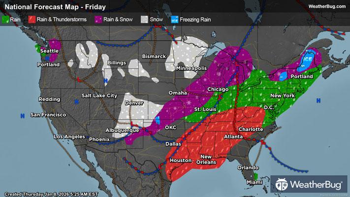
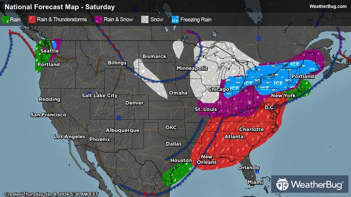
...FLOOD WATCH IN EFFECT FROM FRIDAY MORNING THROUGH SATURDAY MORNING...
* WHAT...Flash flooding caused by excessive rainfall is possible.
* WHERE...A portion of Central Alabama, including the following counties, Autauga, Bibb, Blount, Calhoun, Chambers, Cherokee, Chilton, Clay, Cleburne, Coosa, Dallas, Elmore, Etowah, Fayette, Greene, Hale, Jefferson, Lamar, Marengo, Marion, Perry, Pickens, Randolph, Shelby, St. Clair, Sumter, Talladega, Tallapoosa, Tuscaloosa, Walker and Winston.
* WHEN...From Friday morning through Saturday morning.
* IMPACTS...Excessive runoff may result in flooding of rivers, creeks, streams, and other low-lying and flood-prone locations. Flooding may occur in poor drainage and urban areas.
* ADDITIONAL DETAILS...
- Two to four inches of rainfall is forecast Friday morning through Saturday morning across much of the watch area, with amounts exceeding five inches locally.
- http://www.weather.gov/safety/flood
PRECAUTIONARY/PREPAREDNESS ACTIONS...
You should monitor later forecasts and be prepared to take action should Flash Flood Warnings be issued.
&&