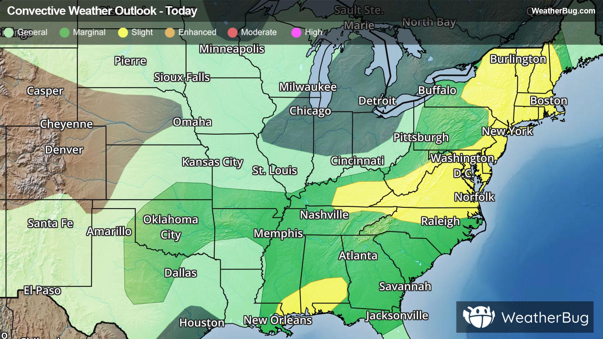
Back to forecast

Today's Weather Outlook

December 16, 2025 at 05:35 AM EST
By WeatherBug Meteorologist, Alyssa Robinette
Tuesday's Weather Outlook

While most of the nation stays dry, Mother Nature has a few tricks up her sleeves today. Parts of the Northern Tier experience wintry weather, with a few showers and storms in the nation’s midsection.

A low pressure system will drift across south-central Canada, allowing a cold front to creep south into the north-central U.S. through the day. Moisture will be limited along this cold front, but there could be some wintry precipitation for the northern Plains, the Upper Mississippi Valley, and the Great Lakes. These spots will see a slight chance for rain and snow showers. Some light freezing rain could also mix in at times. Timing would be in the morning and afternoon for the northern Plains and Upper Mississippi Valley, then the afternoon and evening for the Great Lakes.

Farther west, a fast-moving disturbance and cold front will advance east across the Northwest, northern Rockies, and northern California. Precipitation is likely throughout the day in these spots. However, the best chance will occur in the evening. Rain will be the predominant precipitation type, but temperatures will be cold enough for snow across the northern Cascades as well as the northern Rockies.

Slick, icy, and snowy roads are likely across these mountains and higher elevations where snow falls. At the same time, heavy rain will trigger concerns for flooding across western Washington and western Oregon. Given heavy rain earlier this month and already saturated soils, be prepared for flooding of rivers, creeks, streams, and other low-lying and flood-prone areas. If you do approach a flooded roadway, remember that it is always best to “Turn Around, Don’t Drown!”

If that wasn’t enough, winds will increase throughout the day in the Northwest and Rockies. The strongest winds will occur along the coast of Washington and Oregon, as well as the Cascades. By later in the evening, wind gusts could reach 50 to 65 mph, with locally higher wind gusts possible. Farther east into the Rockies, expect wind gusts between 40 and 50 mph. It will be important to either secure or bring in any holiday decorations. The strong winds combined with the wet, soggy weather could also make power lines and trees more susceptible to falling.

A few other spots join in on the active, unsettled weather. Flurries or very light snow showers cannot be ruled out early in the day across the interior Northeast. Isolated showers and thunderstorms could also develop in the southern Plains and Lower Mississippi Valley in the afternoon and evening.

Otherwise, dry weather will prevail throughout the rest of the southern half of the U.S.

The coldest spot in the nation will be the Great Lakes, Ohio Valley, and Northeast, where highs will reach the 20s and 30s. A few of the tallest peaks in the northern Appalachians could only see temperatures peak in the teens! The Rockies and northern Cascades will generally report highs in the 30s. Expect 40s and 50s across the Northwest, northern California into California’s Central Valley, and the Great Basin, as well as the northern Plains, much of the Mississippi Valley and Tennessee valleys, and the Southeast. Milder 60s and 70s are forecast for the rest of California and the Southwest into the High Plains, the south-central U.S., and the Southeast. A few 80s are also possible in the Desert Southwest.