Back to forecast
Christmas Travel Outlook: Showers in the South, Snow in the West
December 25, 2024 at 03:51 AM EST
By WeatherBug Meteorologist, Alyssa Robinette
Christmas is here, and we have the scoop on the travel forecast whether you’re driving to grandma’s house, jetting out to a tropical island, or having a lovely “staycation.”
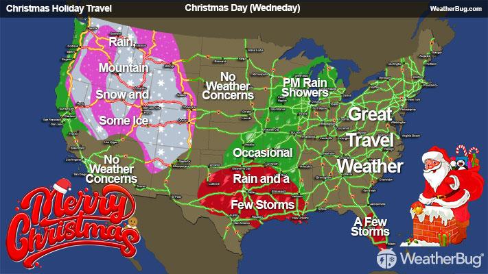
Christmas Day (Today)
A developing system will bring showers and thunderstorms to the Ark-La-Tex region and surrounding areas. While severe weather isn’t a huge concern, localized downpours and gusty winds could cause travel slowdowns on major highways.
Travel Impacts: South-Central U.S.
- Slick roads possible from Texas through Louisiana and into Arkansas, especially on I-20, I-30, and I-49.
- Heavy rain could reduce visibility at times, so be cautious when hydroplaning and ponding on roadways.
- Minor flight delays are possible for airports in Houston, Dallas-Fort Worth, and Shreveport, La., if thunderstorms become widespread.
Another Pacific storm will again bring rain and mountain snow to the Northwest, with higher elevations in the Cascades, Sierra Nevada, and northern Rockies expecting accumulating snowfall, while valleys and coastal areas remain rainy and cool.
Travel Impacts: Northwestern U.S.
- Snow and ice on the mountain passes along I-90, I-84, and portions of I-5 in higher terrain.
- Black ice could develop in the evening as temperatures drop, especially in the Cascades and northern Rockies.
- Minor airport delays are possible for Seattle, Portland, and maybe even San Francisco if rainfall is steady.