White Christmas Outlook: Looking Good For The West, N. Tier
Christmas Day is here! While unseasonably warm temperatures have kept snowfall limited for most, a few places across the northern U.S. are waking up to a White Christmas.
The National Weather Service defines a “White Christmas” as having an inch or more of snow on the ground on Christmas morning.
Leading up to Christmas Day, there was plenty of active weather across the Western U.S. as well as the Northern Tier. However, unseasonably mild temperatures plagued most of the U.S. Consequently, snow will generally be limited to the mountains and higher elevations and areas farther north, close to the U.S.-Canada border.
An upper-level weather system remains nearly stationary off the West Coast this morning, which will continue to funnel plenty of moisture into areas along and west of the Rocky Mountains through today. Heavy rain and mountain snow will impact much of California into the Great Basin and Northwest today, with rain and mountain snow moving into the Rockies.
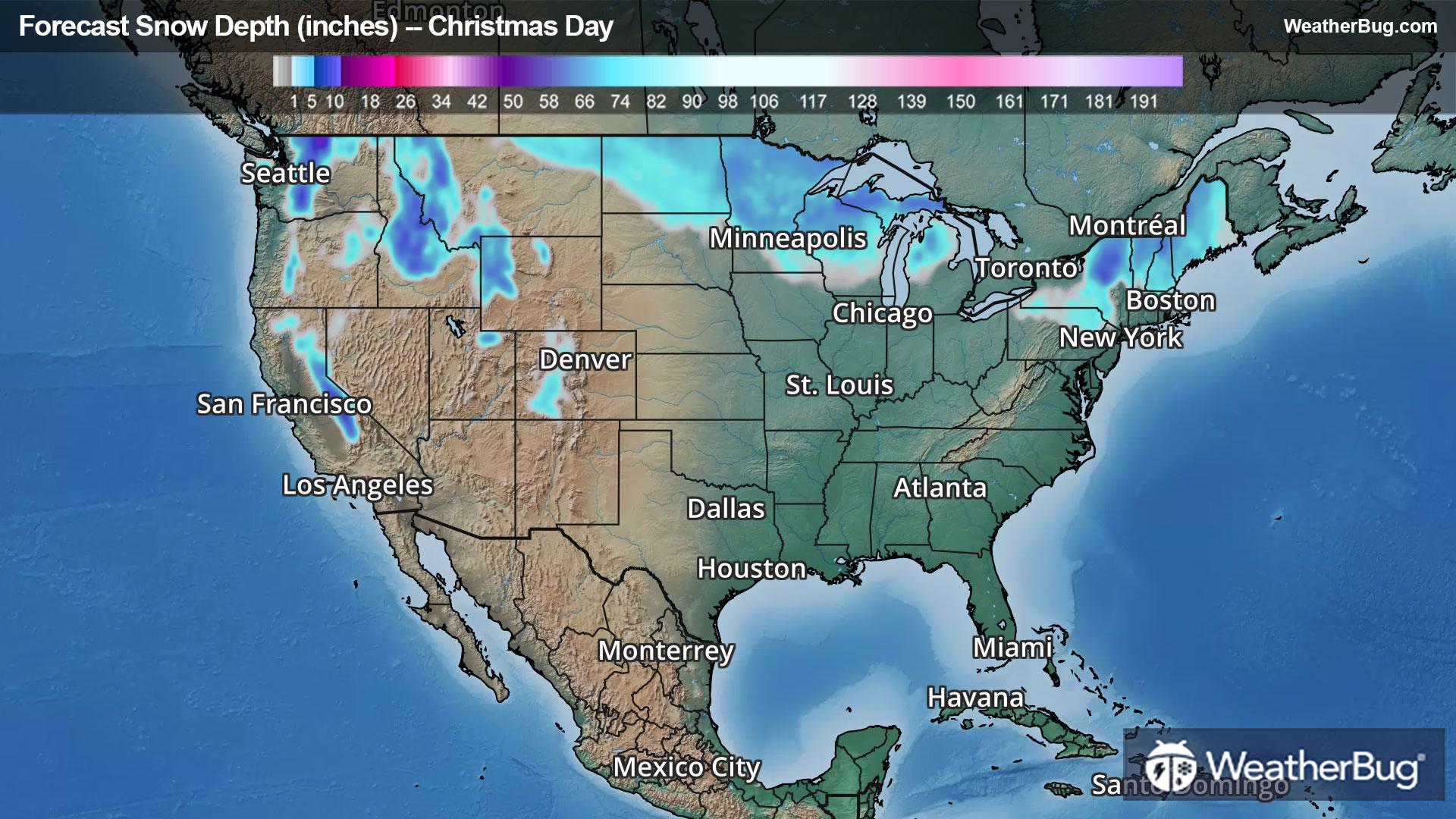
The Klamath Mountains and the Sierra Nevada in California, and the tallest portions of the Rockies in central Idaho, northwestern Montana, and northwestern Wyoming will see the most snowfall on this morning. Here, snowfall totals will add up to 2 to 4 feet or more! The northern Cascades and Olympic Mountains will also be big winners, with 1 to 2 feet of fresh powder.
By Christmas morning, northeastern Washington State, the southern Cascades and Blue Mountains in Oregon, the Toquima Range in Nevada, the Wasatch Mountains in Utah, and the rest of the Rocky Mountains in Idaho, western Montana, south-central Wyoming, and western Wyoming will likely see 6 to 12 inches. A White Christmas will be hit-or-miss across the rest of the Mountain West as snow will be dependent on elevation.
Despite the wintry mess earlier this week, much of the northern Plains, Upper Mississippi, and Upper Great Lakes already have snow on the ground from earlier this month. The best chance of a White Christmas will be in northeastern Montana, northern North Dakota, northern Minnesota, northern Wisconsin, Michigan’s Upper Peninsula, and the northern parts of the Lower Peninsula.
Farther east, the northern Appalachians already have plenty of snow on the ground. Many areas across New England also received several inches of snow this week, with as much as 16 inches or more across portions of southern Maine.
The Pocono Mountains and northern portions of the Allegheny Mountains in Pennsylvania, the Adirondack Mountains in New York, and the White and Green Mountains in northern New England will also likely experience a White Christmas. Chances will drop farther south, so anyone in southern New England or the Mid-Atlantic will have to travel north if they want to have a White Christmas.
Given the mild, above-normal temperatures elsewhere, snow will just be a figment of your imagination, and you will be left to only dream of a White Christmas.
Check back frequently to WeatherBug for the latest on your chances for a White Christmas this week. From all of us at WeatherBug, Happy Holidays!