Central & Southern Plains Under Severe Threat
A low pressure system tracking across the central U.S. will produce severe thunderstorms over the southern Plains today.
Moisture and energy aloft will aid in the development of thunderstorms this afternoon, evening and overnight. Large hail, damaging winds and even a couple tornadoes will be possible.
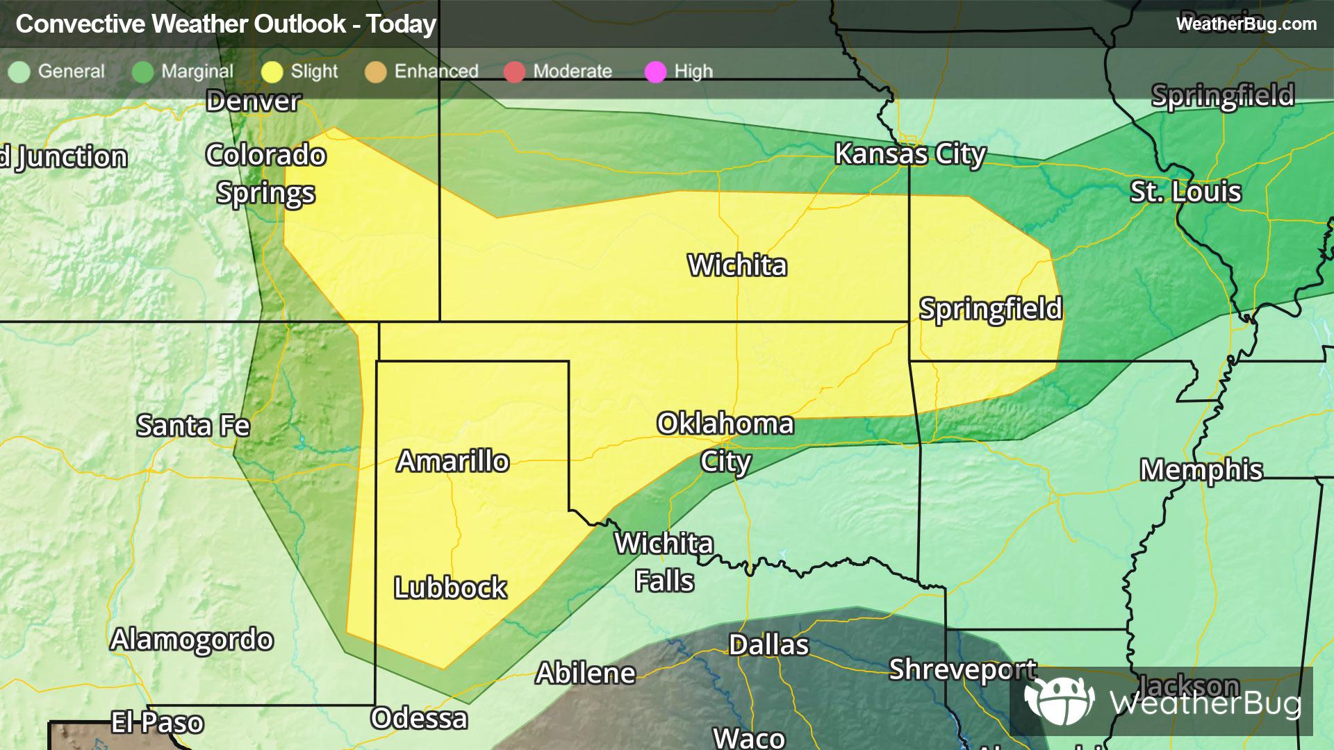
The Storm Prediction Center has issued a Slight Risk from southeastern Colorado and far eastern New Mexico to northwestern Arkansas and southwestern Missouri. Cities included are Garden City and Wichita, Kan., Amarillo and Lubbock, Texas, and Springfield, Mo. Storms will initially form in clusters and line segments, but may eventually evolve into one or two large squall lines later this evening.
Heavy rain and flooding will also be an issue with storms today. Flood Watches are currently in effect from the Central Plains and lower Mississippi Valley to parts of the Ohio Valley. As much as 2 to 4, locally 6 inches of rain is likely to fall over the next couple of days.
Make sure to know the difference between a watch and a warning should they be issued. A "watch" means that conditions are favorable for severe weather to occur, and to be on alert for any rapidly changing conditions. A "warning" means that severe weather is imminent, and you should act fast to remain safe.
The best way to remain safe is to stay prepared and informed about your local weather. Have a severe weather kit packed with a battery-operated radio, water, and non-perishable food items. Also, check the WeatherBug app frequently for any updates on today's severe weather. Remember, "When Thunder Roars, Go Indoors!"