Back to forecast
Christmas Travel Outlook: Significant Travel Concerns for Western U.S.
December 25, 2021 at 05:03 AM EST
By WeatherBug Meteorologist, Alyssa Robinette
Expect plenty of travel headaches if you’re traveling across the Western U.S. today. Weather impacts could also hinder travel at times for the Northern Tier, while it will be worry-free elsewhere.
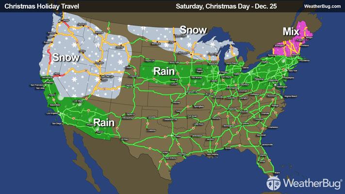
Christmas Day
A warm front in the Great Lakes and Ohio Valley will lift across the Northeast today, with a cold front trailing not far behind it. Rain will be found from Indiana and Ohio into the Delmarva and southern New England, while a wintry mix of snow, freezing rain and rain is frequently expected in interior New England. Slick and icy roads will develop from Upstate New York and Vermont into Maine as a result, including I-87, I-91 and I-95. Otherwise, there shouldn’t be any weather worries for the rest of the Northeast.
Snow will begin to taper off across the Western U.S. this morning. Snow will spread across the northern Plains into the Great Lakes throughout the day. While amounts will stay generally light, it could be enough to cause some slick roads from the Dakotas into northern Minnesota and northern Michigan.
While some parts of the West get a brief reprieve from the snow, it won’t last long as the next round of snow moves in during the afternoon and evening later today. After many days of snow and additional snow expected, hazardous driving conditions are expected for the mountains of the West Coast, portions of the Great Basin and the Mountain West. Roads such as I-15, I-70, I-80, I-84 and I-90 will continue to be in jeopardy of delays or closures.