Back to forecast
Cloud Week: How Do They Form
November 3, 2020 at 06:26 PM EST
By WeatherBug's Erik Gates
Clouds are one the most common weather phenomena; few days go by with truly cloud free skies. The formation of these massive floating cotton balls requires a little more physics and chemistry than one would imagine.
While clouds come in all different shapes and sizes, occupying different levels of the atmosphere, no matter if they’re puffy or thin, they are made up of two things, water or ice.
The air all around us is filled with water, but in its gaseous state. This water vapor is free floating, and its movement can be influenced by outside factors. For clouds to form, there needs to be a way to force air, which is filled with water vapor, upwards.
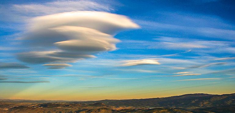
There are four main processes that lift air to heights required for cloud formation. First, we have orographic lift, which is when air is forced upward by a mountain or other topological features. Second, weather fronts can push air upward. Convective lift occurs when sunlight warms the ground and subsequently, the air near the surface. The warm air then rises, allowing for cloud formation. Convection is most associated with the towering cumulonimbus clouds that produce thunderstorms. Lastly, the convergence of air causes lift as the colliding air can’t go anywhere but up.
Now with the air moving upward, the question becomes, how do invisible particles become billowing marshmallows in the sky? As air rises, it naturally expands and cools. As the air cools, it becomes saturated faster. Eventually, the air reaches what is known as the saturation point; it can’t hold any more water vapor. At this point condensation occurs.
With the water vapor at altitude, there needs to be something for the water to condense onto in order for clouds to form easily. This is where cloud condensation nuclei or CCNs come into play. CCNs are tiny, solid particles floating within our atmosphere. Dust, soot, even ocean spray are examples of CCNs. With cloud condensation nuclei, water droplets form easily, the water droplets then coalesce, or come together, eventually forming a cloud. If the water vapor is condensing at a high altitude where the air is well below freezing, the vapor condenses into ice crystals. Wispy cirrus clouds found high in the sky are a prime example of a cloud made of ice.
Clouds “float” in the atmosphere due to the fact that the water droplets or ice crystals they consist of are incredible light. A cloud may weigh hundreds of tons, but the droplets are so tiny and are dispersed over such a large area, that rising air from the surface is enough to suspend the mass of water vapor in the air. Rain can only fall when water droplets coalesce into drops so heavy that gravity wins out over the rising air.
The next time you lay in the grass and watch the clouds, think of the science behind this beautiful facet of weather.
While clouds come in all different shapes and sizes, occupying different levels of the atmosphere, no matter if they’re puffy or thin, they are made up of two things, water or ice.
The air all around us is filled with water, but in its gaseous state. This water vapor is free floating, and its movement can be influenced by outside factors. For clouds to form, there needs to be a way to force air, which is filled with water vapor, upwards.
There are four main processes that lift air to heights required for cloud formation. First, we have orographic lift, which is when air is forced upward by a mountain or other topological features. Second, weather fronts can push air upward. Convective lift occurs when sunlight warms the ground and subsequently, the air near the surface. The warm air then rises, allowing for cloud formation. Convection is most associated with the towering cumulonimbus clouds that produce thunderstorms. Lastly, the convergence of air causes lift as the colliding air can’t go anywhere but up.
Now with the air moving upward, the question becomes, how do invisible particles become billowing marshmallows in the sky? As air rises, it naturally expands and cools. As the air cools, it becomes saturated faster. Eventually, the air reaches what is known as the saturation point; it can’t hold any more water vapor. At this point condensation occurs.
With the water vapor at altitude, there needs to be something for the water to condense onto in order for clouds to form easily. This is where cloud condensation nuclei or CCNs come into play. CCNs are tiny, solid particles floating within our atmosphere. Dust, soot, even ocean spray are examples of CCNs. With cloud condensation nuclei, water droplets form easily, the water droplets then coalesce, or come together, eventually forming a cloud. If the water vapor is condensing at a high altitude where the air is well below freezing, the vapor condenses into ice crystals. Wispy cirrus clouds found high in the sky are a prime example of a cloud made of ice.
Clouds “float” in the atmosphere due to the fact that the water droplets or ice crystals they consist of are incredible light. A cloud may weigh hundreds of tons, but the droplets are so tiny and are dispersed over such a large area, that rising air from the surface is enough to suspend the mass of water vapor in the air. Rain can only fall when water droplets coalesce into drops so heavy that gravity wins out over the rising air.
The next time you lay in the grass and watch the clouds, think of the science behind this beautiful facet of weather.