Back to Now Forecast
Frigid Weather Sends Shivers Down to the Gulf
December 15, 2025 at 05:30 AM EST
UPDATED by WeatherBug Meteorologists
In the path of a weak low-pressure system that brought snow to the Midwest and Northeast, extreme cold weather and brutally cold wind chill values will bring bitter cold to much of the nation.
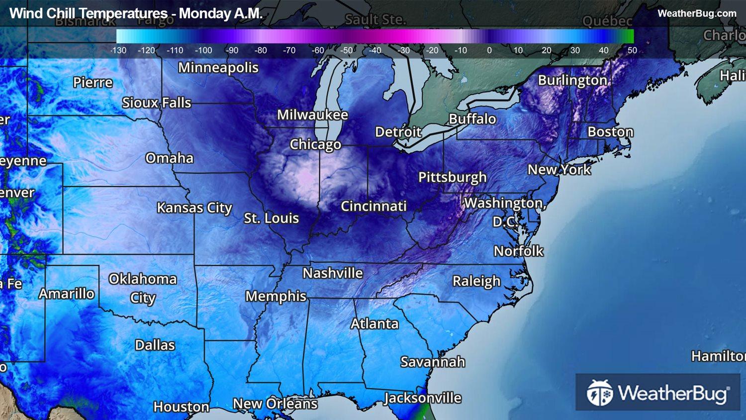
Extremely cold and dry Arctic air will follow the path of a weak low-pressure system that brought snowfall to much of the Midwest and Northeast. This cold air will drop temperatures to negative digits along the Great Lakes. Much of the Midwest and Northeast will see temperatures significantly below freezing, sustaining temperatures in the single digits and teens.
Dangerously cold wind chill values will be the lowest for this morning. Wind chill values will generally be between the negative 20s and 0 degrees across the Midwest and Northeast, with some areas even reaching as low as the negative 40s along the mountaintops of the interior Northeast. Although morning wind chill values will be the lowest overall today, the chill will lighten but linger into Tuesday.
Further south, cold front at the base of the cold air mass has migrated southward, bringing Arctic air into the Tennessee Valley, Mid-Atlantic, and all the way down to the Gulf Coast. As this frigid air stations to the south, many states in the Deep South and Tennessee Valley will feel as cold as temperatures in the teens. Even the Gulf Coast will observe wind chills in the 20s and 30s or below this morning.
For the Gulf Coast, these temperatures will be significantly below average, as average low temperatures at this time of year are in the 40s. These low temperatures will still be a little warmer than last January’s record cold snap, when temperatures along the entire Gulf Coast dropped into the upper teens and lower 20s.
Several Cold Weather Advisories have been issued for these cold temperatures and wind chill values. These advisories are in effect for portions of Indiana, Kentucky, Illinois, and Ohio in the Midwest. In the Mid-Atlantic and the South, they cover portions of Virginia, West Virginia, North Carolina, South Carolina, Tennessee, Georgia, northern Florida, Alabama, Mississippi, Louisiana, and southeastern Texas. Freeze Warnings were also posted for southeastern Texas, southwestern Louisiana, southern Georgia, northern Florida, and far southeastern Alabama.
It’s important to keep in mind that even if there isn’t wintry precipitation present, it is still dangerous to be exposed to these low temperatures for a prolonged period of time. Exposure without proper skin coverage could lead to several cold-related illnesses that are preventable with proper cold-weather preparations.
It’s never too early to have a supply kit packed in case of inclement weather. A simple kit including a weather radio, water, blankets, batteries, and non-perishable food items will go a long way in the event of a power outage. It’s always best to avoid travel in rough weather, as the roads will be dangerous.