


Big Thunderstorms Eye Western Texas to Kansas This Evening
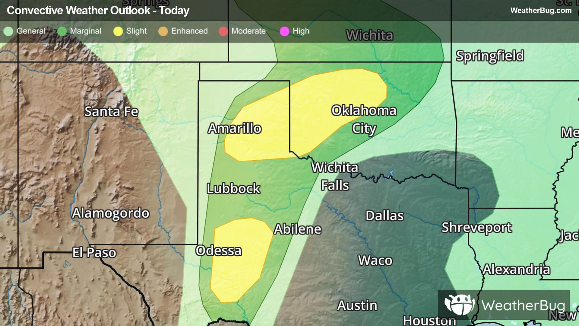
A few big thunderstorms could rumble from western Texas to far southern Kansas through this evening. Damaging wind gusts, large hail, and even a tornado will be possible.
A dry line and surface low pressure coupled with a disturbance aloft over the Great Basin will be the instigator of a few dangerous thunderstorms from parts of West Texas to much of Oklahoma and far southern Kansas through this evening. The primary risks include large hail and damaging wind gusts, though a brief, isolated tornado cannot be completely ruled out.
The Storm Prediction Center has maintained Slight Risks from Fort Stockton to Odessa and Midland, Texas, as well as in the panhandle from Amarillo, Texas, to near the Kansas and Oklahoma border. A Slight Risk is a level 2 of 5 on the severity scale. Hail may get as large as tennis balls and produce wind gusts near 60 to 80 mph. After the sun sets, this activity will rapidly weaken and dissipate before they reach Tulsa, Okla., Wichita, Kan., and well west of the Dallas-Fort Worth Metroplex.
Additional severe weather will be possible on Saturday, a bit further east in Texas and into the northern Plains.
Make sure to know the difference between a watch and a warning should they be issued. A "watch" means that conditions are favorable for severe weather to occur, and to be on alert for any rapidly changing conditions. A "warning" means that severe weather is imminent, and you should act fast to remain safe.
The best way to remain safe is to stay prepared and informed about your local weather. Have a severe weather kit packed with a battery-operated radio, water, and non-perishable food items. Also, check the WeatherBug app frequently for any updates on today's severe weather. Remember, "When Thunder Roars, Go Indoors!"