
Severe Weather Underway For Northern Plains & Upper Midwest
A strengthening low pressure system will produce severe weather across the northern Plains and Upper Midwest today.
A Severe Thunderstorm Watch is in effect for south-central South Dakota.
Energy aloft, a low-level jet and strengthening low pressure will aid in the development of supercells and/or clusters of severe storms from this morning into the overnight hours.
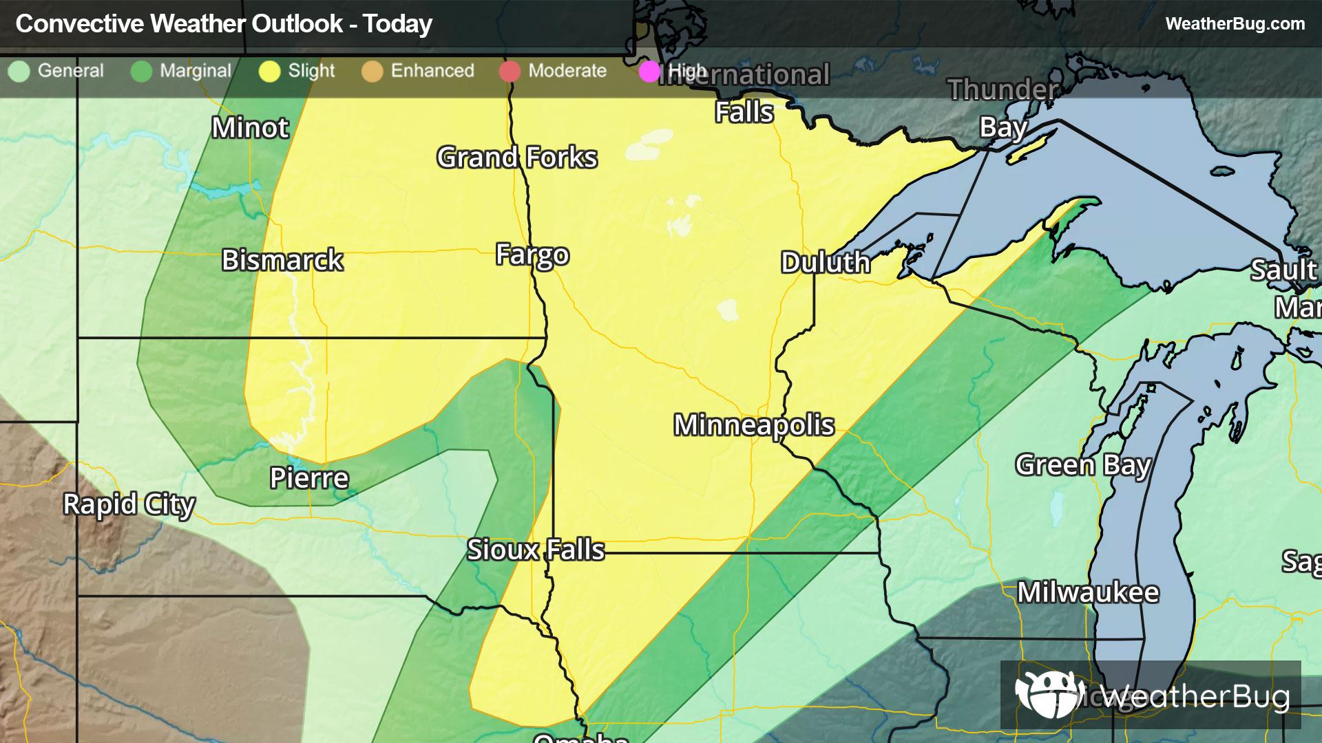
Areas of concern are the eastern Dakotas, Minnesota, northwestern Wisconsin, northeastern Nebraska, far western edge of the Upper Peninsula of Michigan and northwestern Iowa. This is where the Storm Prediction Center has a Slight Risk (level 2 of 5). Cities include Bismarck and Fargo, N.D., Sioux Falls, S.D., and Minneapolis. The main threats are damaging winds, large to very large hail, and even a couple of tornadoes.
In addition, storms may also produce heavy rain amounts of 1 to 3 inches or more which could cause localized flash flooding. Activity will shift eastward into the Upper Great Lakes on Tuesday.
Make sure to know the difference between a watch and a warning should they be issued. A "watch" means that conditions are favorable for severe weather to occur, and to be on alert for any rapidly changing conditions. A "warning" means that severe weather is imminent, and you should act fast to remain safe.
The best way to remain safe is to stay prepared and informed about your local weather. Have a severe weather kit packed with a battery-operated radio, water, and non-perishable food items. Also, check the WeatherBug app frequently for any updates on today's severe weather. Remember, "When Thunder Roars, Go Indoors!"