Back to forecast
Storms, Downpours Sweep Across Northwest
May 31, 2020 at 12:40 AM EDT
UPDATED By WeatherBug Meteorologists
The weather pattern is leaving no stone unturned this week in the U.S. Following the late week rash of storms that socked the East, attention has quickly turned to the Northwest. A strong low pressure is not only bringing needed rain but also a dangerous severe storm outbreak.
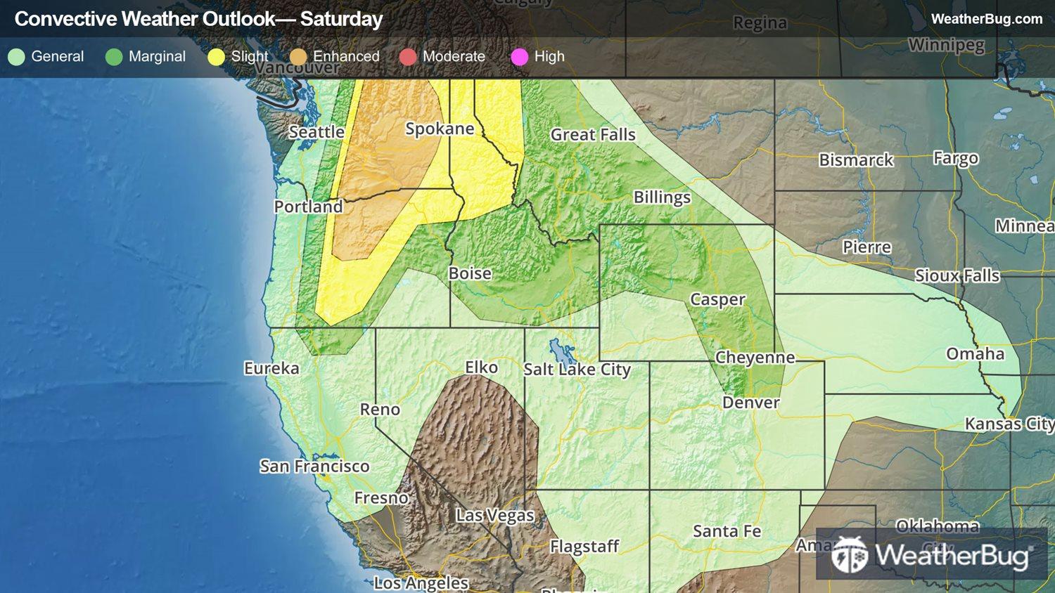
Low pressure hauling into the Northwest is producing occasional heavy rain showers and even severe thunderstorms. Peanut sized hail pelted Crescent, Ore., and North Bend, Wash., so far today. Additional thunderstorms will multiply and intensify across the interior Northwest as the day unfolds.
As a matter of fact, a Severe Thunderstorm Watch is in effect for northern Washington State, which is the same spot where an Enhanced Risk for severe weather is expected today. Klamath Falls, Burns, and Pendleton, Ore., and Walla Walla, Wash., are included. Besides the few hail reports noted so far today in the Northwest, gusty winds exceeding 57 mph and hail that could approach golf ball size are likely in the more robust storms across interior Washington and Oregon. A brief tornado can't be ruled out either.
The severe threat will slowly end after sunset but the showers will likely continue in the Northwest. So far today, the highest rainfall amounts of one-half to one inch have drenched southern Oregon and northern California, with up to one-third of an inch along Interstate 5 between Seattle and Portland, Ore.
While the rain is needed in the parched Northwest, too much at once will lead to sharp rises in streams and creeks, which could contribute to low-lying flash and urban flooding. “Turn Around, Don’t Drown” when approaching a flooded roadway because the water is usually deeper than what it appears.
Besides severe weather and heavy rain, storms will produce frequent lightning, which could easily spark brushfires. This is due to the dry soil in place thanks to the extensive drought gripping the Northwest.
The same system will make headway deeper into the Mountain West on Sunday. Glasgow, Mont., Rapid City, S.D., Cheyenne, Wyo., and Denver are just a few spots where threatening weather could occur late Sunday, although the severe risk is by far not as significant as today’s risk in the interior Northwest.
Make sure you know the difference between a watch and warning should they be issued. A watch means that severe weather conditions are possible, and you should be aware of rapidly changing skies. A warning means that severe weather is imminent, and you should take cover immediately. Remember, “When Thunder Roars, Go Indoors!”