Back to forecast
East Coast Gets Soaked In Rain
March 6, 2024 at 05:56 PM EST
By WeatherBug Meteorologist, Mark Ellinwood
Widespread moderate to heavy rain will move through the eastern U.S. today into Thursday. Another storm system will keep the region wet heading into the weekend.
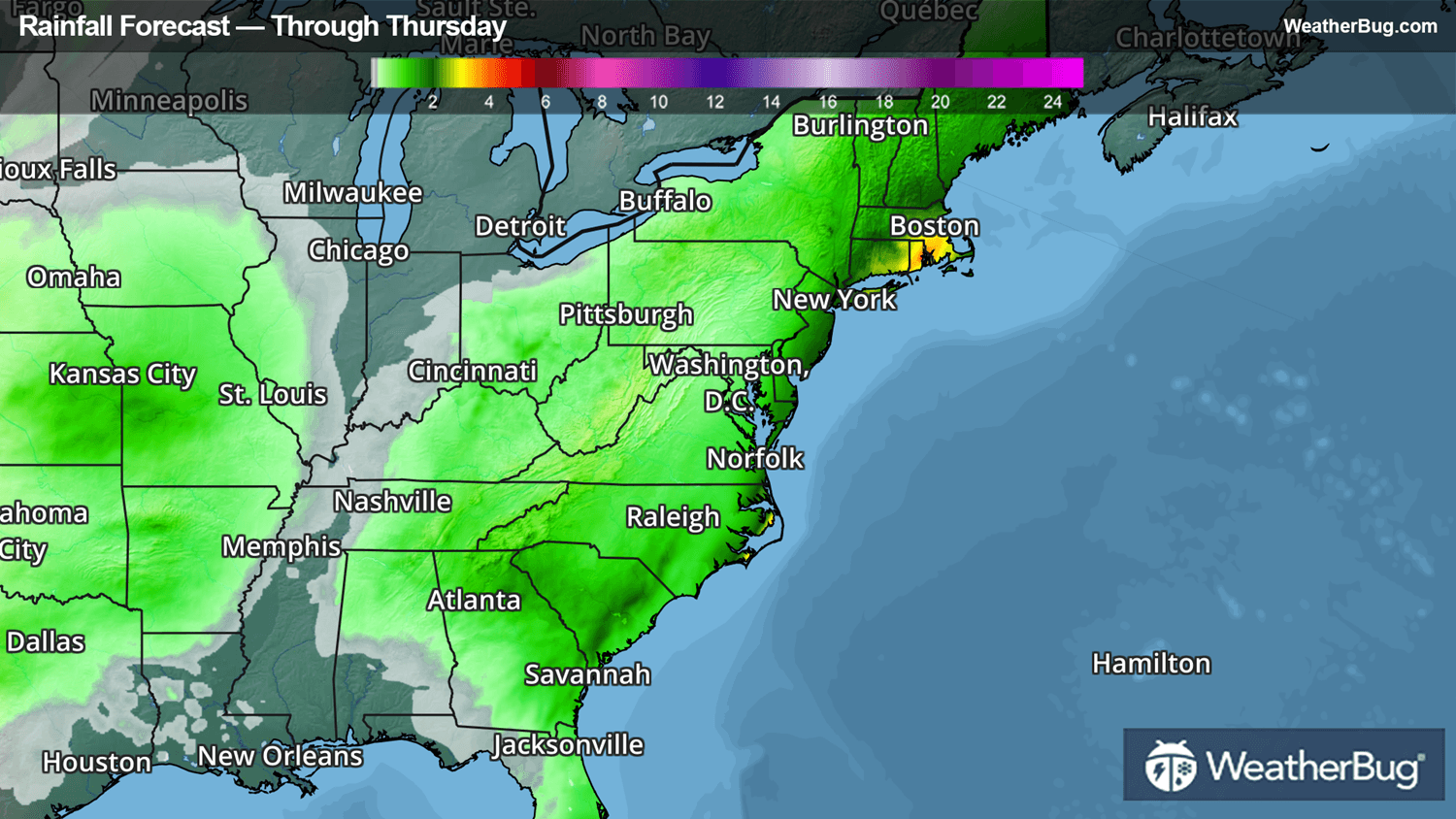
A disturbance will make its way from the Southeast to the New England coast through midweek, bringing widespread rain with it. In the Southeast, the rain will be accompanied by embedded thunderstorms. In northern Maine, it will be cold enough for snow to develop this evening into Thursday morning.
Rain will continue to spread across the Carolinas and Florida this morning, eventually making its way up through the Mid-Atlantic and Northeast this afternoon and evening. The I-95 corridor will see its heaviest rain late this afternoon into Thursday morning, with some showers lingering in the Northeast Thursday afternoon and evening.
There will be widespread rain amounts of 0.5 to 1.5 inches in southern Florida, the Carolinas, the coastal Mid-Atlantic, and across the Northeast over the next two days. Locally higher rainfall of 1.5 to 2.5 inches will likely occur from eastern New Jersey and New York City up through southern and eastern New England.
Flood Watches are in effect from central New Jersey and Long Island into Rhode Island, most of Connecticut, central and eastern Massachusetts, southern and central New Hampshire, and southern Maine. This includes the I-95 corridor from the New York City metro up through Boston.
If the rain weren't enough, snow will develop across the northern half of Maine this evening and will continue through Thursday morning. Snow accumulations of 1 to 4 inches are possible, along with locally higher amounts of 4 to 6 inches.
Remember, “Turn Around, Don’t Drown!” if you approach a flooded roadway and stay tuned to the WeatherBug app, website, and social media over the coming days for updates on this event.