Back to forecast
Explained: Winter Warnings, Watches and Advisories
December 6, 2022 at 03:25 PM EST
By WeatherBug's Richard Romkee
National Weather Service offices issue a plethora of weather alerts during the cold season. What are they, and when are they issued?
The main goal of the National Weather Service, and of meteorologists in general, is to protect lives and property. This is what drives the warning process – it’s the fastest, easiest and most efficient way to inform people about inclement and potentially hazardous weather.
In general, advisories and warnings are put in place when confidence is reasonably high in impactful weather. Every National Weather Service office has certain conditions that have to be met for a given alert to be issued, with great care taken to make sure that the timing and impact forecasts are as accurate as possible given all the available data.
The most important alerts are issued ahead of large snowstorms which have the capability to halt or severely impact travel. Blizzard Warnings are the most serious winter weather alert, and they are issued when snow, either already on the ground or falling from the sky, is expected to combine with wind gusts over 35 mph to create blowing snow and reduced visibility below a quarter of a mile. Blizzards can prevent travel, damage tree branches and knock out power, which is why it’s a great idea to have non-perishable food and flashlights at the ready when a blizzard comes to town.
When heavy snow is expected but wind won’t be as much of a factor in impacting travel, winter storm alerts come into play. A Winter Storm Watch is issued up to 3 days ahead of a winter storm where significant snowfall or freezing rain is expected. When one is issued for your region, it’s a good idea to pay close attention to the weather forecast in coming days as the details of the potential storm come into focus.
When confidence is high that dangerous winter weather will occur, a Winter Storm Warning is issued. Every National Weather Service office has different criteria, but generally they are put in place when 4 to 8 inches of snow is expected in 12 hours or less. These numbers tend to be a lot lower in tropical areas (for obvious reasons), and far higher for mountainous terrain. Timing and forecast confidence factor into this as well – even a relatively small amount of snow can cause major problems if it falls in a major city during the morning or evening commute. Regardless, winter storm warnings are a big deal and
Lake Effect Snow Warnings are similar to winter storm warnings, but focused on heavy lake effect snow mainly in upstate New York. Snowfall rates can reach up to 4 inches per hour under the most intense lake effect snow bands, occasionally paralyzing travel across the affected region.
Ice Storm Warnings are issued when accumulating freezing rain is expected, primarily for totals over a quarter of an inch. Ice storms are dangerous as they can make roads very slick and dangerous to travel on, and accumulated ice can also bring down power lines leading to widespread power outages.
Winter Weather Advisories are a little more varied, and are issued for accumulating snowfall, sleet, freezing rain or freezing drizzle which could cause tough travel. As with Winter Storm Warnings, their issuance is complex and mostly impact based – for example, a Winter Weather Advisory could be issued for a large city if 1 to 3 inches of snow falls during the morning rush hour. If a Winter Weather Advisory is issued for your neighborhood, plan on a longer and slower than usual drive to work or school but few other impacts.
One more noteworthy precipitation related winter weather alert is the Snow Squall Warning. These are issued for heavy snow showers that produce gusty winds and sudden reductions in visibility. They are issued in the same way that tornado and severe thunderstorm warnings are issued, lasting 30 to 60 minutes for a very limited area delineated by a warning polygon. These warnings are issued to keep motorists safe, as snow squalls have been responsible for major pileups in recent years. If you’re driving when a snow squall warning gets issued, it’s a good idea to pull off the road and wait for the squall to pass.
Last but certainly not least are Wind Chill Watches, Warnings and Advisories. These are issued when cold temperatures and gusty winds are expected to combine to produce a significant risk of hypothermia to anyone caught outside without the proper protection. As with the precipitation-based warnings, the thresholds for these alerts are highly location dependent with lower thresholds in locations that rarely see cold weather. For example, Wind Chill Warnings are issued for wind chills below minus-35 degrees in North Dakota, and below 35 degrees in Miami.
Although warnings are generally meant to indicate more significant weather than advisories, both categories are worth your attention. Hopefully, this information will help prepare you for whatever weather winter sends your way.
Source: NWS
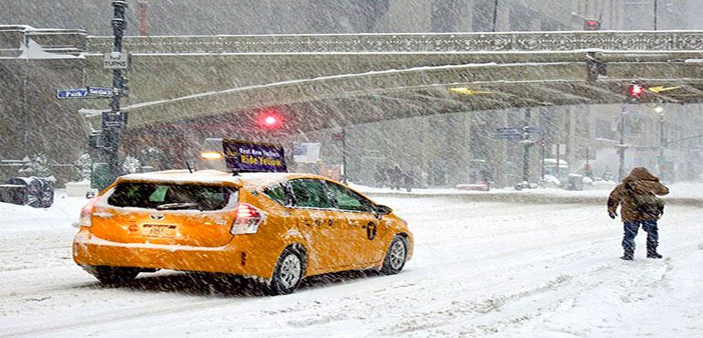
Story Image: Manhattan, New York during a snowstorm on January 23, 2016. (Danazar via Wikimedia Commons)
The main goal of the National Weather Service, and of meteorologists in general, is to protect lives and property. This is what drives the warning process – it’s the fastest, easiest and most efficient way to inform people about inclement and potentially hazardous weather.
In general, advisories and warnings are put in place when confidence is reasonably high in impactful weather. Every National Weather Service office has certain conditions that have to be met for a given alert to be issued, with great care taken to make sure that the timing and impact forecasts are as accurate as possible given all the available data.
The most important alerts are issued ahead of large snowstorms which have the capability to halt or severely impact travel. Blizzard Warnings are the most serious winter weather alert, and they are issued when snow, either already on the ground or falling from the sky, is expected to combine with wind gusts over 35 mph to create blowing snow and reduced visibility below a quarter of a mile. Blizzards can prevent travel, damage tree branches and knock out power, which is why it’s a great idea to have non-perishable food and flashlights at the ready when a blizzard comes to town.
When heavy snow is expected but wind won’t be as much of a factor in impacting travel, winter storm alerts come into play. A Winter Storm Watch is issued up to 3 days ahead of a winter storm where significant snowfall or freezing rain is expected. When one is issued for your region, it’s a good idea to pay close attention to the weather forecast in coming days as the details of the potential storm come into focus.
When confidence is high that dangerous winter weather will occur, a Winter Storm Warning is issued. Every National Weather Service office has different criteria, but generally they are put in place when 4 to 8 inches of snow is expected in 12 hours or less. These numbers tend to be a lot lower in tropical areas (for obvious reasons), and far higher for mountainous terrain. Timing and forecast confidence factor into this as well – even a relatively small amount of snow can cause major problems if it falls in a major city during the morning or evening commute. Regardless, winter storm warnings are a big deal and
Lake Effect Snow Warnings are similar to winter storm warnings, but focused on heavy lake effect snow mainly in upstate New York. Snowfall rates can reach up to 4 inches per hour under the most intense lake effect snow bands, occasionally paralyzing travel across the affected region.
Ice Storm Warnings are issued when accumulating freezing rain is expected, primarily for totals over a quarter of an inch. Ice storms are dangerous as they can make roads very slick and dangerous to travel on, and accumulated ice can also bring down power lines leading to widespread power outages.
Winter Weather Advisories are a little more varied, and are issued for accumulating snowfall, sleet, freezing rain or freezing drizzle which could cause tough travel. As with Winter Storm Warnings, their issuance is complex and mostly impact based – for example, a Winter Weather Advisory could be issued for a large city if 1 to 3 inches of snow falls during the morning rush hour. If a Winter Weather Advisory is issued for your neighborhood, plan on a longer and slower than usual drive to work or school but few other impacts.
One more noteworthy precipitation related winter weather alert is the Snow Squall Warning. These are issued for heavy snow showers that produce gusty winds and sudden reductions in visibility. They are issued in the same way that tornado and severe thunderstorm warnings are issued, lasting 30 to 60 minutes for a very limited area delineated by a warning polygon. These warnings are issued to keep motorists safe, as snow squalls have been responsible for major pileups in recent years. If you’re driving when a snow squall warning gets issued, it’s a good idea to pull off the road and wait for the squall to pass.
Last but certainly not least are Wind Chill Watches, Warnings and Advisories. These are issued when cold temperatures and gusty winds are expected to combine to produce a significant risk of hypothermia to anyone caught outside without the proper protection. As with the precipitation-based warnings, the thresholds for these alerts are highly location dependent with lower thresholds in locations that rarely see cold weather. For example, Wind Chill Warnings are issued for wind chills below minus-35 degrees in North Dakota, and below 35 degrees in Miami.
Although warnings are generally meant to indicate more significant weather than advisories, both categories are worth your attention. Hopefully, this information will help prepare you for whatever weather winter sends your way.
Source: NWS
Story Image: Manhattan, New York during a snowstorm on January 23, 2016. (Danazar via Wikimedia Commons)