Back to forecast
Fresh Round Of Snow Targets Interior Northeast
December 7, 2024 at 05:38 PM EST
By WeatherBug Meteorologist, Rob Miller
After days of lake-effect snow have buried portions of the interior Northeast, a quick-moving system is bringing another round of light snow through Sunday.
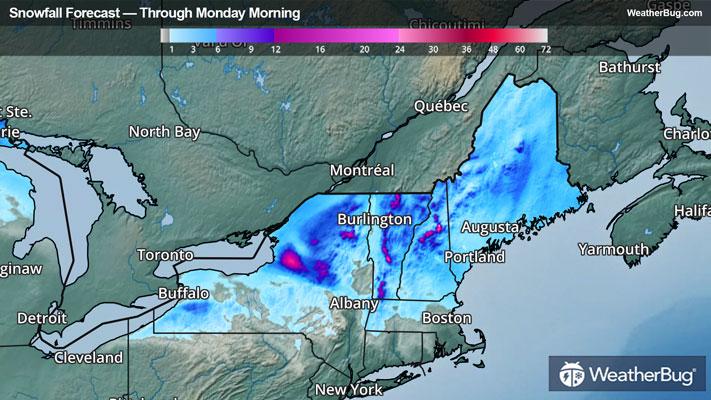
An area of low pressure dove southeastward along a front across the northern Great Lakes today. With plenty of cold air in place, snow will continue to spread into and across the Northeast tonight and Sunday, ending in most areas by Sunday evening as the clipper storm exits.
A general 1 to 4 inches of snow will blanket much of Upstate New York into western Massachusetts, Vermont, New Hampshire, and Maine. Locally higher amounts will be possible in the higher elevations, as well as east of Lakes Ontario and Erie.
As a result, Winter Storm Warnings and Advisories are in effect into Sunday. In addition to the snow, gusty winds will continue at times today into Sunday. Wind Advisories are posted over western New York where wind gusts of 45-50 mph will be possible, especially this evening and tonight.
If you must travel, keep an extra flashlight, food and water in your vehicle in case of emergency. Be sure to have multiple ways to get the latest weather information from local TV, weather radio, or the WeatherBug app. With bitterly cold air in place, it is the time to check on the elderly, keep pets inside and dress in as many layers as possible to avoid hypothermia.