

Friday's Weather Outlook
The workweek comes to a close with showers and thunderstorms for much of the U.S.
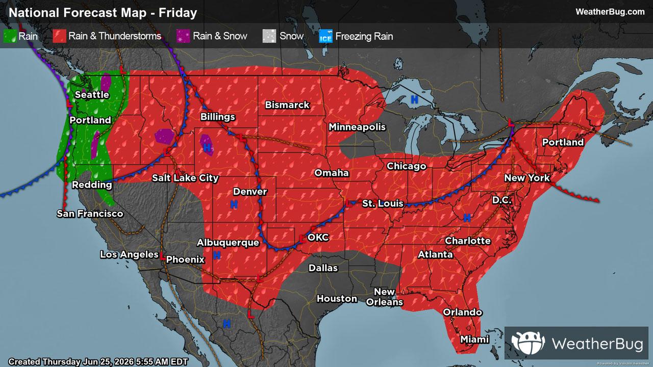
Friday will feature active weather across the country with clear skies spread few and far between. The East Coast, as well as the Lower Midwest, Great Plains, Mountain West, and the Pacific Northwest can expect cloudy skies along with scattered showers and possible thunderstorms throughout the day. Additionally, although June is winding down, a mix of rain and snow comes back into the forecast for the tallest peaks of the Rockies and Cascades.
In the afternoon and evening hours, storm cells will further develop, organize, and intensify, especially in the Mountain West, Lower Midwest and Mid-Atlantic. Remember, the best way to stay safe is to be prepared and informed about your local weather, such as checking the WeatherBug app for any weather updates.
Otherwise, much of California, Nevada, Arizona, Utah, Texas, Louisiana, Wisconsin, and Michigan can anticipate for the most part to stay high and dry, with clear or partly cloudy skies.
Unseasonably cool temperatures will persist across the Northeast, Midwest, along with the Central and High Plains, where high temperatures will range from the 60s through the 80s. Meanwhile, the Mid-Atlantic down through the Southeast can anticipate highs to be in the 80s and 90s.
Across the West, temperatures will vary significantly. The warmest readings will be in the Desert Southwest as well as western Texas and the southwestern Plains. However, In the Mountain West and the Pacific Northwest, coastal regions and areas of higher elevations can expect temperatures ranging from the 40s to the 60s.