Drenching Rain, Powerful Storms Pepper Eastern U.S., Near Front Range
Heavy rainfall and powerful thunderstorms could pepper the Eastern U.S. to begin the new work week, while a separate disturbance packs big hail concerns along and just east of the Front Range.
After wreaking havoc in the Ohio and Mississippi valleys and Plains on Sunday, an area of low pressure will shift east and bring plentiful thunderstorms for the Mid-Atlantic and parts of the Southeast. Fast flow aloft and copious instability will trigger plenty of thunderstorms. Given the hot, humid air in place, some of the activity will be strong to severe.
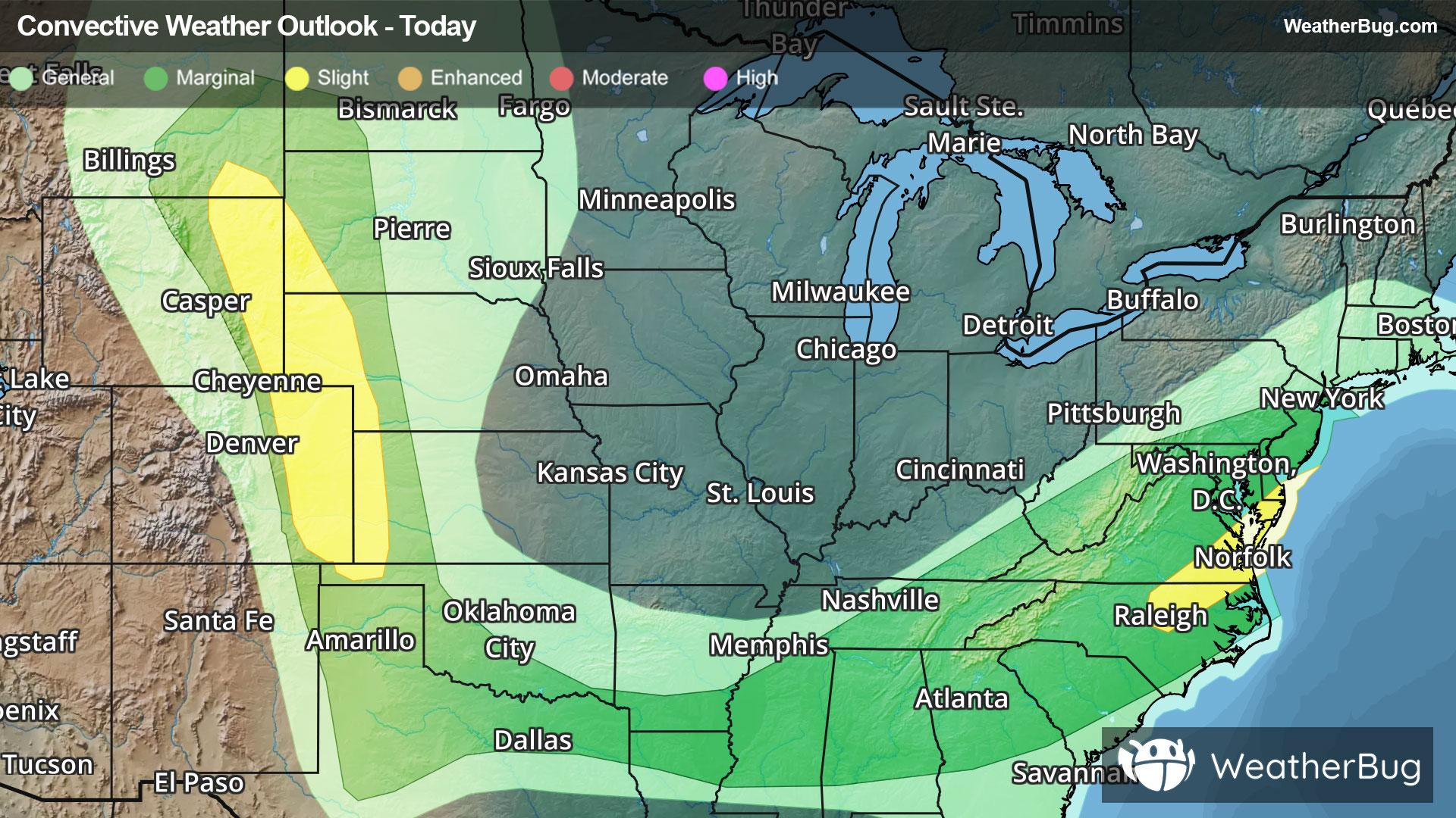
Severe Thunderstorm Watches are in effect for eastern Colorado and eastern Wyoming to southwestern South Dakota as well as southeastern Virginia. Virginia Beach, Va. and Rapid City, S.D.
The government's Storm Prediction Center has maintained a Slight Risk (level 2 of 5) from central North Carolina northeast to coastal Delaware and coastal New Jersey. A second zone extends from far western Kansas and eastern Colorado to eastern Wyoming and far southeastern Montana.
Cities such as Norfolk, Va., Raleigh, N.C., Ocean City, Md., and Cheyenne, Wyo., will need to keep a watchful eye to the sky for threatening weather this afternoon and evening.
Scattered damaging wind gusts up to 70 mph, isolated very large, destructive hail in excess of baseball size, and a brief tornado or two will be possible.
Heavy, flooding rainfall will be a byproduct of intense thunderstorm activity also. One to 2 inches falling in a short time, combined with the existing, significant drought across much of the Eastern Seaboard, could foster urban and poor drainage flooding, particularly where excess runoff will overwhelm storm drains. Flood Watches sporadically cover the Ark-La-Tex area of the western Tennessee and lower Ohio valleys to near central Appalachia. If you approach a road covered in water, it is best to “Turn Around, Don’t Drown!”
Make sure to know the difference between a watch and a warning should they be issued. A "watch" means that conditions are favorable for severe weather to occur, and to be on alert for any rapidly changing conditions. A "warning" means that severe weather is imminent, and you should act fast to remain safe.
The best way to remain safe is to stay prepared and informed about your local weather. Have a severe weather kit packed with a battery-operated radio, water, and non-perishable food items. Also, check the WeatherBug app frequently for any updates on today's severe weather. Remember, "When Thunder Roars, Go Indoors!"