Heavy Rain Slides Across The Deep South
The back half of the week will feature drought-denting rains from the Gulf States into the Carolinas.
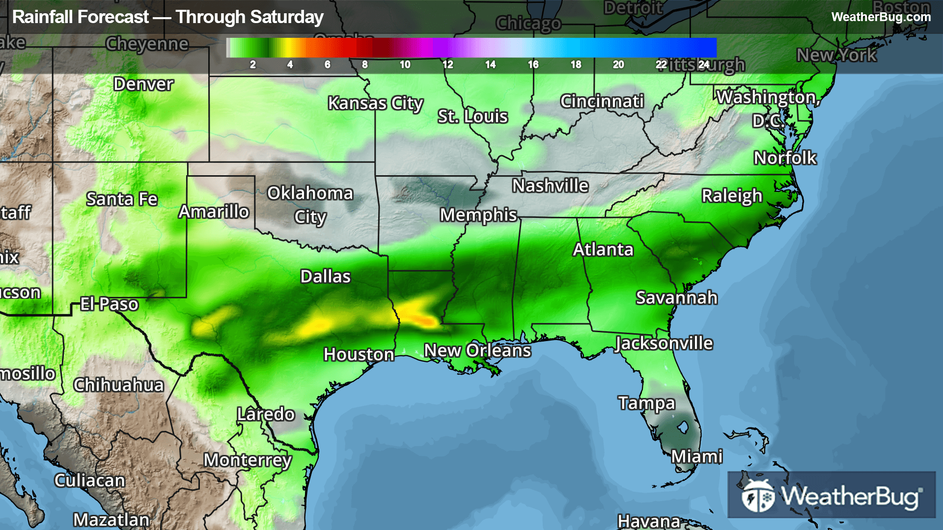
A developing disturbance will enter the southern Plains today, which will interact with a stalled front near the Gulf Coast. Moderate to heavy rain will stretch from central Texas into southern Louisiana and southern Mississippi through tonight, with some areas receiving 1 to 2 inches of rainfall.
The storm system will become better organized on Friday as it moves across the Gulf states, with a wide swath of moderate to heavy rain extending from Texas to Georgia. Rainfall will range between 1 to 3 inches across much of the Deep South on Friday, with locally higher 3 to 4 inch amounts possible in southeastern Texas and central and southern Louisiana. This could lead to areas of flash flooding. Be weather-aware in low-lying and urban areas, and remember, “Turn Around, Don’t Drown!”
Saturday will see the disturbance evolve into a coastal storm as it works through the Southeast and into the western Atlantic Ocean. Moderate to heavy rain will trail the core of the system from Alabama, Georgia, and northern Florida into the eastern Carolinas. These locations could receive 0.5 to 1.5 inches of rainfall in Saturday, with locally higher amounts up to 2 inches possible.
Much of the Deep South is in Severe to Extreme drought, so the multiple inches of rain will be very beneficial to these areas that are running a long term deficit. It won't be enough to remove the long term drought conditions, but it will certainly provide good short term relief as warmer May temperatures start to enter the picture.