


Heavy Rains to Soak Portions of the Carolinas
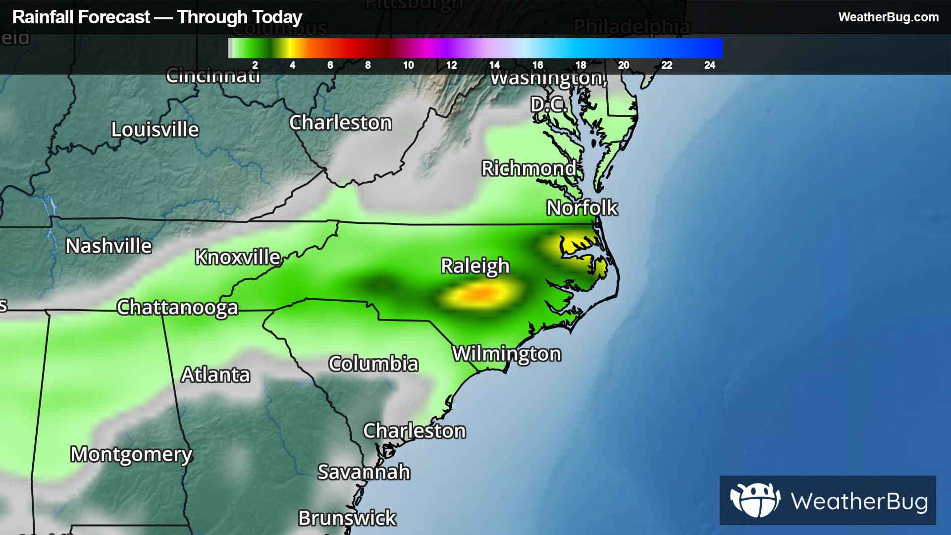
The Carolinas will be the focal point for heavy rainfall through the end of the week.
A stalled cold front interacting with a very warm and humid airmass will cause heavy rain that could cause flooding over the next couple of days. An area of high pressure found to the north of this front will keep this feature nearly stationary and will cause some locations to get repeatedly soaked by showers and thunderstorms. Some locations in eastern North Carolina could see as much as 3-5 inches of rain.
Flood Watches are in place across extreme southern Virginia, almost all of North Carolina, southeastern Tennessee, extreme northern Georgia and a small section of northeast Alabama. This includes cities such as Raleigh and Fayetteville in N.C., Virginia Beach, Va., Gainesville, Ga., and Gadsden, Ala.
Slow moving downpours that are followed by another round of heavy rain will be a big concern and could cause too much rain in too short of a time. Nearly saturated soils may not be able absorb all of this water and could lead to runoff causing urban flooding as well as local streams, creeks and rivers to overflow their banks.
Remember if a roadway is flooded, "Turn Around, Don't Drown!". This will likely lead to travel delays across this region of the country. Flooding is a leading cause of weather-related fatalities with more than half of flood-related casualties occurring in automobiles when attempting to cross high water. Just six inches of fast-flowing water can sweep a grown adult away while twelve inches can overtake small cars. It is never safe to drive or walk through flooded roadways.