High-Impact Severe Weather Expected Across Midwest & Mid-Atlantic
A low pressure system and an upper level disturbance will bring two areas of dangerous severe weather today.
From the Upper Great Lakes to the southern Plains will be the first area of severe weather where very large hail, damaging wind gusts, heavy rain, and even strong tornadoes are a possibility. This comes after an already active day on Wednesday where hundreds of damaging wind reports and over a dozen tornado reports came in across the Midwest into the Plains.
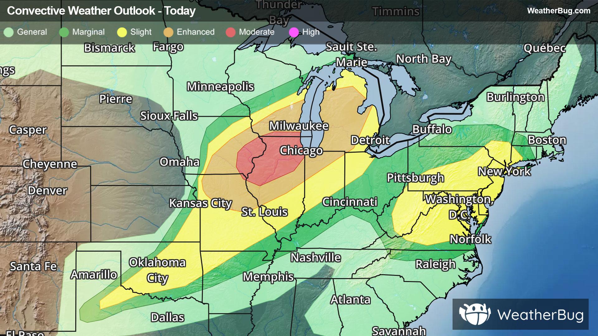
The Storm Prediction Center has highlighted a Moderate Risk (Level 4 of 5) in far northeastern Missouri, eastern Iowa, far southern Wisconsin, and northern Illinois.
Surrounding this area, there is an Enhanced Risk (Level 3 of 5) from northeastern Missouri and southeastern Iowa to much of Michigan.
A Slight Risk (Level 2 of 5) is shown from the Panhandle of Texas to northern and eastern Michigan. Cities include Chicago, Milwaukee, Wis., Des Moines, Iowa, St. Louis, and Oklahoma City, Okla. Clusters and line segments will develop throughout much of the day along the cold front before finally weakening tonight near the Tennessee and Ohio Valleys.
Another disturbance may produce large hail and damaging winds this afternoon and evening from the Virginias to southeastern New York and western Connecticut. This is where a Slight Risk has been highlighted. Major cities along the I-95 corridor included are Washington, DC, Baltimore, Philadelphia and New York City.
A Tornado Watch is in effect for central, south, and eastern Iowa, northeastern Missouri, and northwestern Illinois.
A Severe Thunderstorm Watch is in effect for central and southern Iowa, along with northwestern Missouri.
Make sure to know the difference between a watch and a warning should they be issued. A "watch" means that conditions are favorable for severe weather to occur, and to be on alert for any rapidly changing conditions. A "warning" means that severe weather is imminent, and you should act fast to remain safe.
The best way to remain safe is to stay prepared and informed about your local weather. Have a severe weather kit packed with a battery-operated radio, water, and non-perishable food items. Also, check the WeatherBug app frequently for any updates on today's severe weather. Remember, "When Thunder Roars, Go Indoors!"