Back to forecast
Hurricane Preparedness: Understanding Watches and Warnings
May 24, 2021 at 08:21 AM EDT
By WeatherBug's Christopher Smith
The official start of hurricane season is just over one week away. Let’s review the different watches and warnings in case you are placed in one in the coming months.
Source: weather.gov
----------
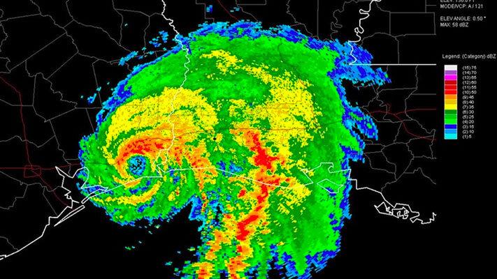
Story Image: Radar imagery of Hurricane Humberto making landfall in High Island, Texas, on September 13, 2007 (NOAA Photo Library/NWS Lake Charles).
- Tropical Storm Watch: There is a possibility of tropical storm force winds within 48 hours. Tropical storm force winds are defined as sustained winds between 39 and 73 mph.
- Hurricane Watch: Sustained winds of 74 mph or greater are possible for your area. These watches are issued 48 hours before tropical storm force winds are expected as any preparations need to be complete before the winds pick up.
- Storm Surge Watch: This type of watch is fairly new and is issued if life-threatening flooding from rising water near the shoreline is expected within 48 hours.
- Tropical Storm Warning: Sustained winds between 39 and 73 mph are expected within 36 hours.
- Hurricane Warning: Hurricane-force winds of 74 mph or greater are expected and tropical storm force winds should start within 36 hours. If you are in an evacuation area, final preparations should be made and you should leave the area immediately.
- Storm Surge Warning: Life-threatening flooding from rising waters near the shore is expected within 36 hours. It is crucial to listen to local officials and evacuate if necessary.
- Extreme Wind Warning: This is a short-term warning that is issued if extreme winds of 115 mph or greater, the force of a major hurricane, are expected within an hour. The eyewall of a hurricane usually produces the most dangerous winds and the warning can be issued once it is possible to predict where the eyewall may go.
Source: weather.gov
----------
Story Image: Radar imagery of Hurricane Humberto making landfall in High Island, Texas, on September 13, 2007 (NOAA Photo Library/NWS Lake Charles).