


Lala Strengthens Into Hurricane Impacting Hawaii
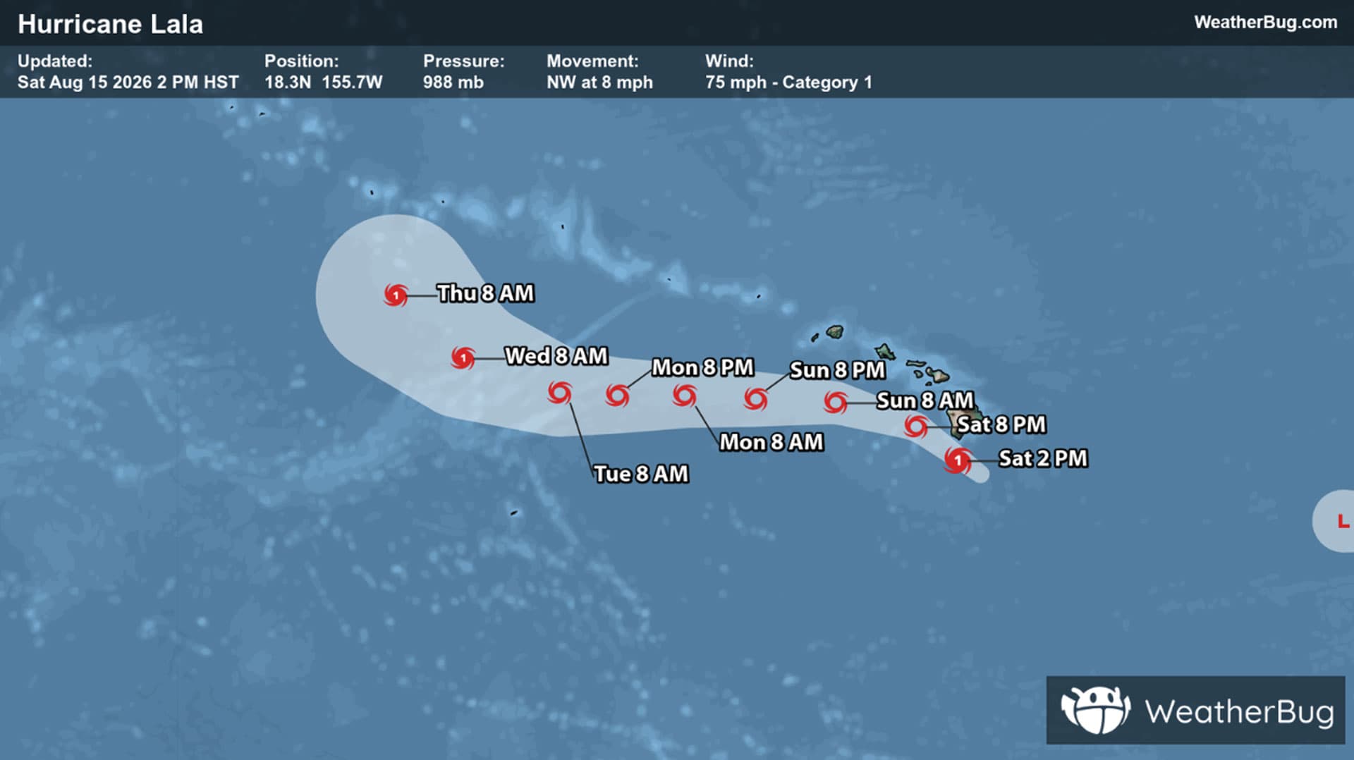
Lala strengthens into a hurricane and will impact Hawaii significantly over this weekend.
In the central Pacific, as of 2 p.m. HST (8 p.m. EDT), Hurricane Lala was located near 18.3N, 155.7W, or about 50 miles south of the southern tip of the Big Island, and 250 miles southeast of Honolulu. Lala is moving at 8 mph towards the northwest, with winds of 75 mph. Its central pressure is 29.18 inches, or 988 mb.
A Hurricane Warning is in effect for the Big Island while a Tropical Storm Warning is in place for Oahu, Kauai, Niihau, Maui, Molokai, Lanai and Kahoolawe.
The Big Island will experience the biggest impacts with Lala throughout today with heavy rain and strong winds as the primary concerns. With the mountainous terrain, flash flooding and mudslides are anticipated. Peak rain amounts and strongest winds will likely stay close to the center’s path across the Big Island. Hurricane-force winds are likely here with tropical-storm force winds anticipated for the rest of the island chain.
Hurricane Lala is also expected to bring plenty of rainfall to Hawaii. Across the Big Island, common rainfall totals are anticipated to range from 8 to 16 inches, but some areas could see up to 25 inches of rain. In Maui, slightly lower totals are expected, but will still range 4 to 10 inches with locally up to 10 to 15 inches of rain. Meanwhile, the rest of the island chain is expected to see rainfall totals from 2 to 4 inches, however isolated totals could be as high as 8 inches. Life-threating flooding and mudslides, especially in areas of steep terrain are possible. Typically dry areas along the coast will likely be flooded by the tide and storm surge where water levels can climb 1 to 3 feet above normal.
Its geographic position in the tropics obviously makes Hawaii a candidate for tropical systems, although it is rare for a tropical system to survive to the 50th state. Cooler water to Hawaii’s east acts as a shield, leaving only a handful of systems to approach. Remnants of these storms are what typically bring heavy rain and wind to Hawaii as they pass the region.
The better bet for tropical development comes from those storms that develop well to the south and southeast of the islands. Here, the storm can avoid the cool water shield and organize into a powerful storm. The best example of this pattern would be Hurricane Iniki, which pummeled Kauai and the western islands in September 1992 as it approached from the south.
Residents as well as visitors to the Hawaiian Islands should take extra precautions and remain informed on evacuation routes and even backup routes in case the preferred route is blocked. Non-perishable foods and clean water as well as an electricity source to charge necessary electronics will be very helpful in case the power goes out.