Back to forecast
Heavy Snow Falls In The Northeast; Strong Winds Continue In East
February 13, 2024 at 12:12 PM EST
UPDATED by WeatherBug Meteorologists
A quick-moving but potent area of low pressure will pass through the Northeast today, poised to provide the northern Mid-Atlantic to southern New England with a fresh batch of snowfall.
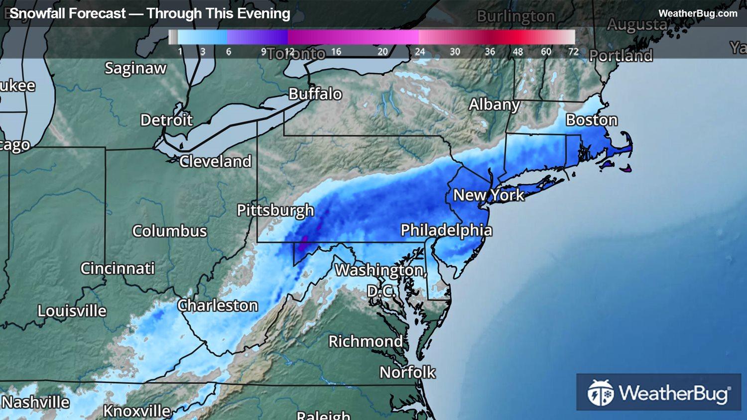
The winter storm’s origins are the same low pressure system that brought snow to parts of the South and Ohio Valley on Monday. Warm air will take precedence for most areas, but a narrow band of cold air will produce a swath of heavy snow from Pennsylvania into southern New England through this evening.
The low pressure system will zip eastward across the Mid-Atlantic, moving off the southern New England coastline later this morning, feeding and rapidly intensifying with the Atlantic waters of the Gulf Stream. The combination of the storm’s moisture and the cold air in place will lead to a heavy, wet snow developing along the Interstate 80 and 84 corridors of Pennsylvania and New York through southern New England.
Winter Storm Warnings and Winter Weather Advisories are in effect across parts of New Jersey, southeastern New York and southern New England. Here, snow will quickly accumulate on the order of 5 to 10 inches through this evening.
The heavy, wet nature of the snow is likely to cause some tree limbs to break, leading to power outages. Be sure to have flashlights, batteries and a winter supply kit at the ready in case you lose power.
Further south, rain has ended for most areas in the southern Mid-Atlantic into the Southeast, but strong winds are expected to continue through much of the day today. As such, widespread High Wind Warnings and Wind Advisories have been issued from northern Georgia to southern West Virginia. Sustained winds will be anywhere from 15 to 30 mph with gusts up to 40 to 50 mph, resulting in possible power outages.
The good news is that the storm should exit offshore completely by this evening, leaving a fresh, beautiful snowpack for those affected in time for Valentine’s Day. As an aside from your friends at WeatherBug – heavy, wet snow is best for making snow-couples or a pre-Valentine’s snowball fight.