Back to forecast
More Severe Weather Targets Texas
April 29, 2023 at 03:06 AM EDT
By WeatherBug Meteorologist, Rob Miller
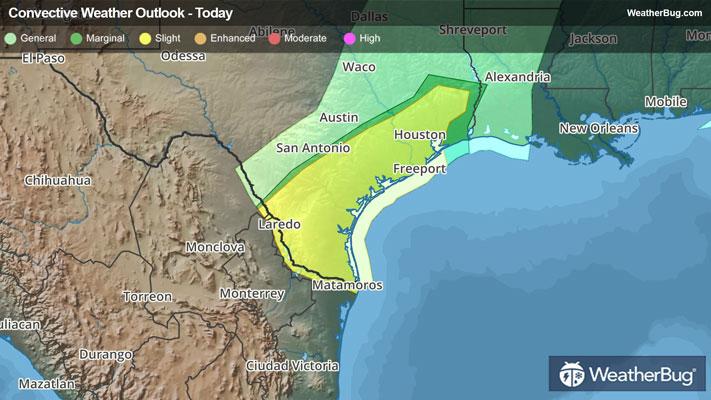
Another round of severe weather continues to target southeastern Texas, with hail and damaging winds targeting the Gulf Coast.
Aided by a strong upper air disturbance, a cold front will sink slowly south and eastward across Texas tonight. With plenty of warm, humid air ahead of this front, and cooler, drier air behind the front, the contrasting air masses will help fuel severe thunderstorm development during the afternoon and evening hours.
Earlier today, baseball sized hail was reported near Hamilton, Texas, and egg-sized hail was reported in Bandera, Texas. A gust to 76 mph was reported on a boat ramp near Morgan’s Point, Texas.
Make sure to know the difference between a watch and a warning should they become issued. A watch means that conditions are favorable for severe weather to occur and to be on alert for any rapidly changing conditions. A warning means that severe weather is imminent, and you should act fast to remain safe.
The best way to remain safe is to stay prepared and informed about your local weather. Have a severe weather kit packed with a battery-operated radio, water and non-perishable food items should you be without power for long periods of time. Also, check the WeatherBug app frequently for any updates on today’s severe weather. Remember, “When Thunder Roars, Go Indoors!”