Nor'easter Dumps Record Snow in Northeast
A historic nor’easter will crank out several more hours of locally heavy snowfall from Maine to eastern Massachusetts, leaving many in need of a yardstick to measure the snow.
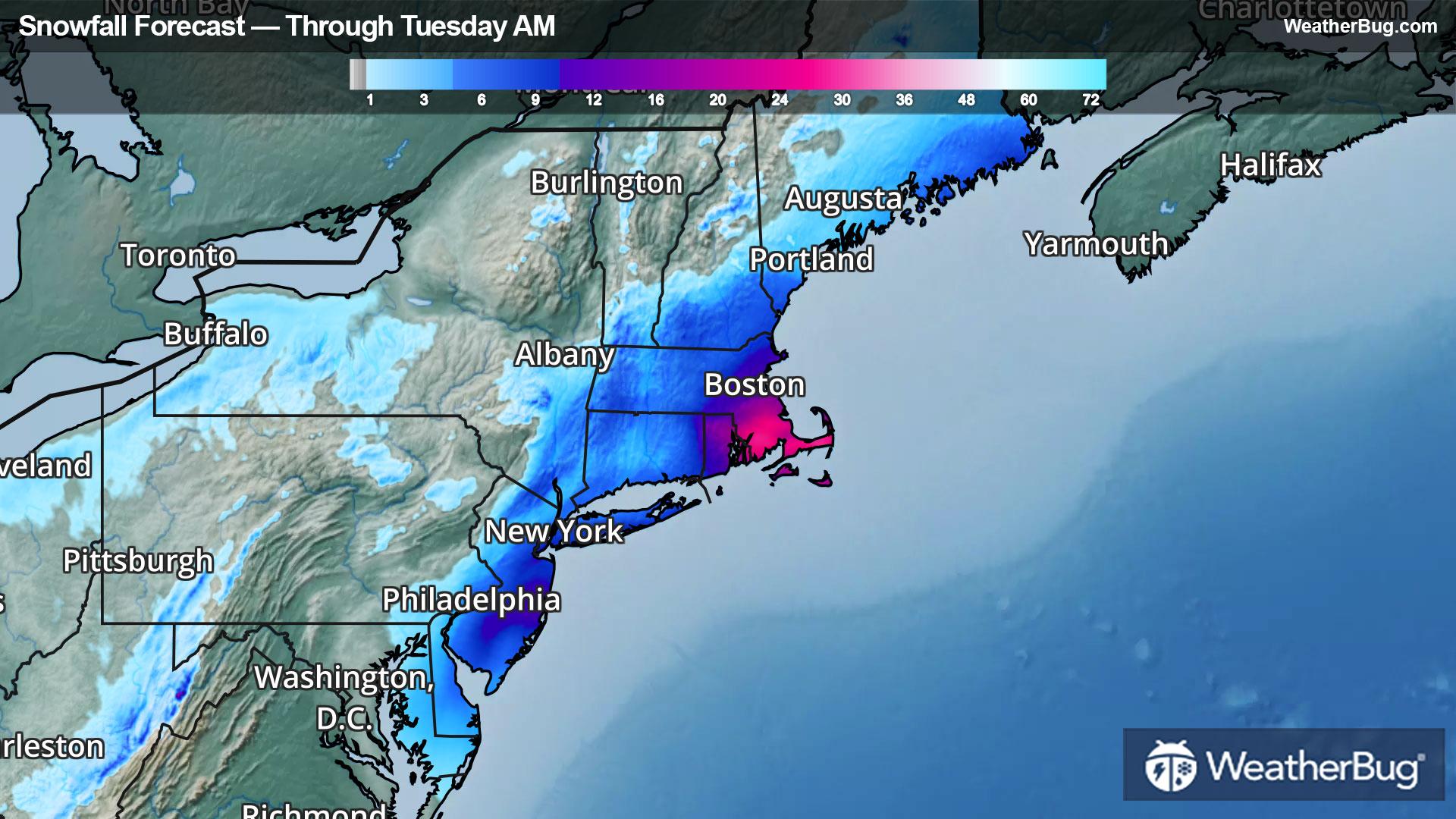
A powerful storm system is beginning to move away from Cape Cod, Mass., this evening. It will race into Atlantic Canada early on Tuesday morning, but not before leaving residents in eastern Massachusetts to New York City, New Jersey, and the Delmarva Peninsula buried in feet of snow!
A handful of moderate to heavy snow bands continue to fall around the storm’s outer circulation from eastern Maine to Rhode Island and eastern Massachusetts this evening. This activity will exit offshore in eastern Massachusetts shortly before Midnight and by early Tuesday morning in Maine.
Blizzard Warnings remain in effect until late tonight or Tuesday morning. Winter Storm Warnings and Winter Weather Advisories extend farther inland, covering much of Maine to central and southern New Hampshire, eastern Massachusetts, and Rhode Island. Frequent gusts peaking at 40 to 60 mph will combine with additional snowfall totals of 1 to 3 inches, leading to significantly reduced visibility and near whiteout conditions at times. Providence, R.I., Boston, Mass., Manchester and Concord, N.H., and Portland, Augusta, and Bangor, Maine, are included.
Meanwhile, similar snowy, gusty wind issues persist along northern and central Appalachia tonight. Winter Storm Warnings and Winter Weather Advisories are in effect through early Tuesday morning. An additional couple inches of snow and gusts up to 45 mph will create slippery, treacherous travel in places like Charleston and Beckley, W. Va., to Boone, N.C.
This storm has been memorable, maybe even historic! T.F. Green Airport in Providence, R.I., measured a record-breaking 37.9 inches at 7 p.m. this evening. Incredibly, this amount crushed the February 6th and 7th Blizzard of 1978! So many spots in southeastern Massachusetts and Rhode Island were buried by 2 to 3 feet of snow! The storm’s footprint, including 1 to 2 feet totals, blankets Delaware and New Jersey to Long Island and Connecticut; more than a foot locally is on track for parts of eastern Maine, too.
Nearly every big city from Boston and Worcester, Mass., to Hartford, Conn., Central Park, N.Y., and Philadelphia measured record daily snowfall totals today. East Farmington, N.Y., picked up 27.5 inches for a storm total, while Liberty International Airport in Newark, N.J., rocketed past 2 feet at 27.2 inches. Westport, New Bedford, and Acushnet, Mass., joined the 2-foot-plus club with 32, 31, and 31 inches, respectively.
Feet of dense snow sticking to every tree branch and power line, combined with gusts up to 60 to 80 mph, has led to more than 275,800 power outages in southeastern Massachusetts. Eighty-five percent of Barnstable County on Cape Cod, Mass., is without power, with more than 75,500 residents in Plymouth County, Mass., or nearly 36-percent of the county, are without power tonight. More than 129,000 residents are without power from New Jersey to Delaware and Maryland as well.
Be sure to download the WeatherBug app to stay up to date on the latest evolving weather conditions. It’s never too early to have a supply kit packed in case of inclement weather. A simple kit including a weather radio, water, blankets, batteries, and non-perishable food items will go a long way in the event of a power outage.