Back to forecast
On This Day in 1989: Hurricane Hugo to Slam South Carolina
September 20, 2021 at 03:05 PM EDT
By WeatherBug's Intern Meteorologist, Christopher Smith
On this day 32 years ago, Hurricane Hugo was approaching landfall in South Carolina. Hugo would become one of the state’s worst natural disasters on record.
Hurricane Hugo had origins in the far eastern Atlantic near the Cape Verde Islands. Tracking westward, the storm intensified and eventually became a monster Category 5 hurricane, the highest category on the Saffir-Simpson scale, packing sustained winds of 160 mph. After slightly weakening to a Category 4 hurricane, Hugo slammed the northeast Caribbean before turning northwest on a path straight toward the Southeast U.S. Coast.
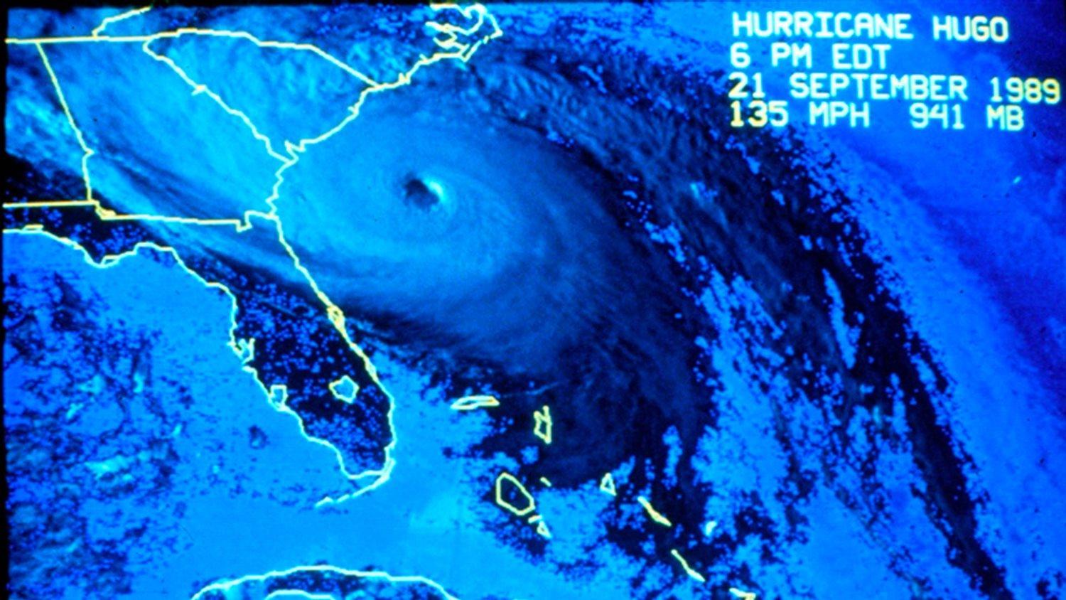
On September 21, 1989, Hurricane Hugo was approaching the South Carolina Coast and began impacting the state with relentless rain, wind and storm surge. Around midnight on September 22, Hugo made landfall as a Category 4 hurricane with sustained winds of 135 mph winds near Sullivan’s Island, S.C.
The impacts from Hugo were devastating. Wind gusts over 100 mph were reported in Charleston, S.C., and hurricane-force wind gusts were reported as far inland as Charlotte, N.C., as Hugo pushed rapidly to the northwest. Storm surge as high as 16 feet was reported in McClellanville, S.C., nearly 40 miles northeast of Charleston, S.C. Rainfall amounts of 5 to 10 inches were widespread across coastal areas of South Carolina.
Damages from Hurricane Hugo totaled nearly $20 billion in today’s currency and Hugo was responsible for 86 deaths in its lifetime. Millions of acres of trees were damaged and in South Carolina alone, 37 percent of the state’s timberland was impacted.
The only positive aspect of Hugo was that it made landfall north of Charleston, S.C., sparing the populated city from the worst impacts. If Hugo made landfall over or to the south, the city would have faced much higher winds and storm surge, causing much more destruction.
Sources: weather.gov, srs.fs.usda.gov
----------
Story Image: Satellite imagery of Category 4 Hurricane Hugo approaching the South Carolina coastline at 6 p.m. EDT on September 21, 1989. (NOAA Photo Library/NHC)
Hurricane Hugo had origins in the far eastern Atlantic near the Cape Verde Islands. Tracking westward, the storm intensified and eventually became a monster Category 5 hurricane, the highest category on the Saffir-Simpson scale, packing sustained winds of 160 mph. After slightly weakening to a Category 4 hurricane, Hugo slammed the northeast Caribbean before turning northwest on a path straight toward the Southeast U.S. Coast.
On September 21, 1989, Hurricane Hugo was approaching the South Carolina Coast and began impacting the state with relentless rain, wind and storm surge. Around midnight on September 22, Hugo made landfall as a Category 4 hurricane with sustained winds of 135 mph winds near Sullivan’s Island, S.C.
The impacts from Hugo were devastating. Wind gusts over 100 mph were reported in Charleston, S.C., and hurricane-force wind gusts were reported as far inland as Charlotte, N.C., as Hugo pushed rapidly to the northwest. Storm surge as high as 16 feet was reported in McClellanville, S.C., nearly 40 miles northeast of Charleston, S.C. Rainfall amounts of 5 to 10 inches were widespread across coastal areas of South Carolina.
Damages from Hurricane Hugo totaled nearly $20 billion in today’s currency and Hugo was responsible for 86 deaths in its lifetime. Millions of acres of trees were damaged and in South Carolina alone, 37 percent of the state’s timberland was impacted.
The only positive aspect of Hugo was that it made landfall north of Charleston, S.C., sparing the populated city from the worst impacts. If Hugo made landfall over or to the south, the city would have faced much higher winds and storm surge, causing much more destruction.
Sources: weather.gov, srs.fs.usda.gov
----------
Story Image: Satellite imagery of Category 4 Hurricane Hugo approaching the South Carolina coastline at 6 p.m. EDT on September 21, 1989. (NOAA Photo Library/NHC)