Parade of Storms Hits The Plains, Midwest
Severe thunderstorms are moving across the central U.S. this evening, bringing strong winds, hail and tornadoes from Wisconsin to Michigan.
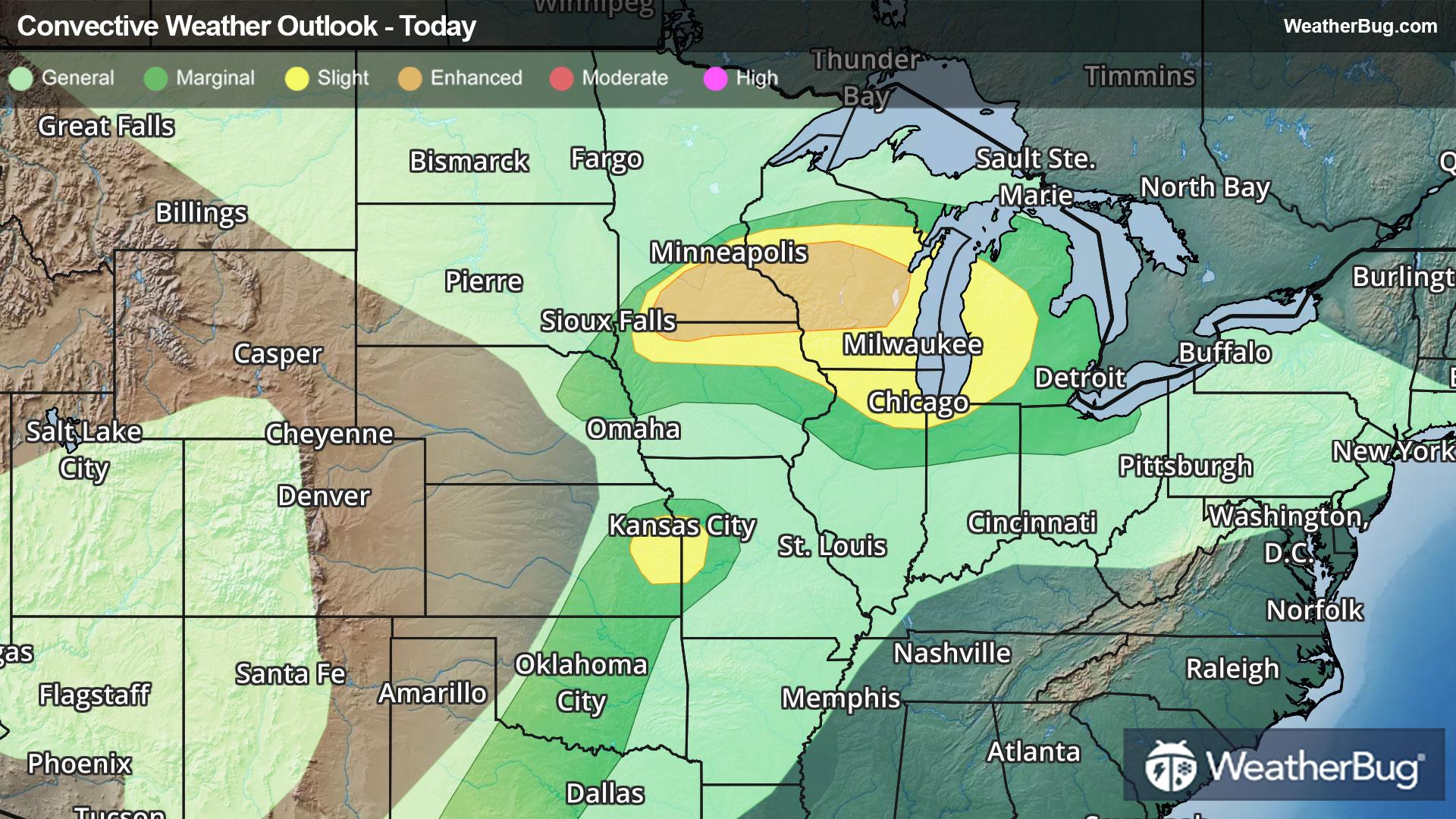
The focus on today’s severe weather will be along a cold front draped across the central U.S. The Storm Prediction Center has issued Slight and Enhanced Risks (levels 2 and 3 out of 5) from Minnesota and Iowa to Michigan, as well as in the Kansas City metro area. Large hail will be the primary concern, along with gusty winds up to 60 mph. A few tornadoes are also possible.
A Severe Thunderstorm Watch remains for a small portion of southern Wisconsin to Lower Michigan.
For Tuesday, there is a Slight Risk from central Texas northeastward across the middle Mississippi Valley and parts of the Midwest. There is even an Enhanced Risk from eastern Iowa into southern Wisconsin and northern Illinois. All modes of severe weather will be possible within the Slight and Enhanced Risks. Locally heavy rain up to 1 to 2 inches is also possible within these storms, which could lead to pockets of flash flooding.
Flood Watches are in effect across parts of northern Wisconsin, all of Michigan's Upper Peninsula, and northern portions of Michigan's Lower Peninsula from later today into Tuesday morning.
Make sure to know the difference between a watch and a warning should they be issued. A "watch" means that conditions are favorable for severe weather to occur, and to be on alert for any rapidly changing conditions. A "warning" means that severe weather is imminent, and you should act fast to remain safe.
The best way to remain safe is to stay prepared and informed about your local weather. Have a severe weather kit packed with a battery-operated radio, water, and non-perishable food items. Also, check the WeatherBug app frequently for any updates on today's severe weather. Remember, "When Thunder Roars, Go Indoors!"