


Several Severe Thunderstorms Target Central U.S.
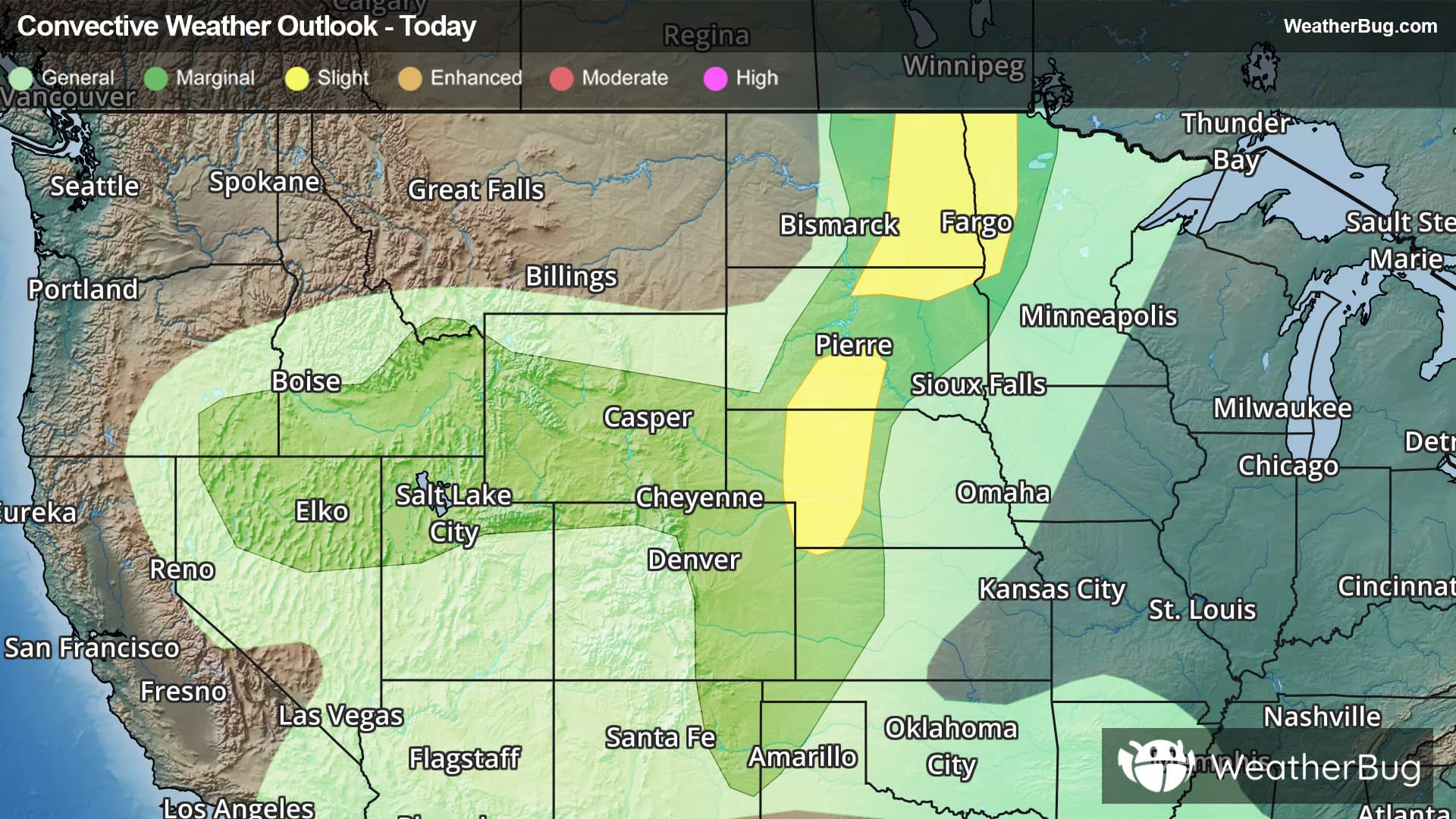
An abundance of severe weather threats will hit the central U.S. today.
A low pressure system moving through Alberta and Manitoba will push a cold front through the central and north-central U.S. With plenty of moisture, gusty winds aloft, and the front acting as a trigger for storm development, the environment is conducive for severe weather development.
The government's Storm Prediction Center has posted two Slight Risks, a 2 out of 5 on the severe weather probability scale, for eastern North Dakota and northwestern Minnesota as well as southwestern South Dakota and western Nebraska. Cities including Detroit Lakes and Fergus Falls, Minn., Fargo and Grand Forks, N.D., Badlands National Park and North Platte, Neb., could experience damaging wind gusts in excess of 65 mph and hail larger than hen eggs, while those in eastern North Dakota may see an additional threat of isolated tornadoes.
Severe Thunderstorm Watches are in effect from west-central Nebraska through eastern North Dakota and far northwestern Minnesota.
Be sure to know the difference between a watch and a warning. A watch means that the conditions are in place to possibly produce severe weather, while a warning indicates that those conditions are currently occurring. Be sure to have multiple ways to receive warnings. Also, take caution if you are outdoors during a thunderstorm. Remember, “When Thunder Roars, Go Indoors!”