Record-Breaking Cold Maligns the Northeast
An Arctic high pressure system has settled over the Northeast, continuing frigid temperatures and wind chills across Appalachia, the Northeast, and the Mid-Atlantic through early next week.
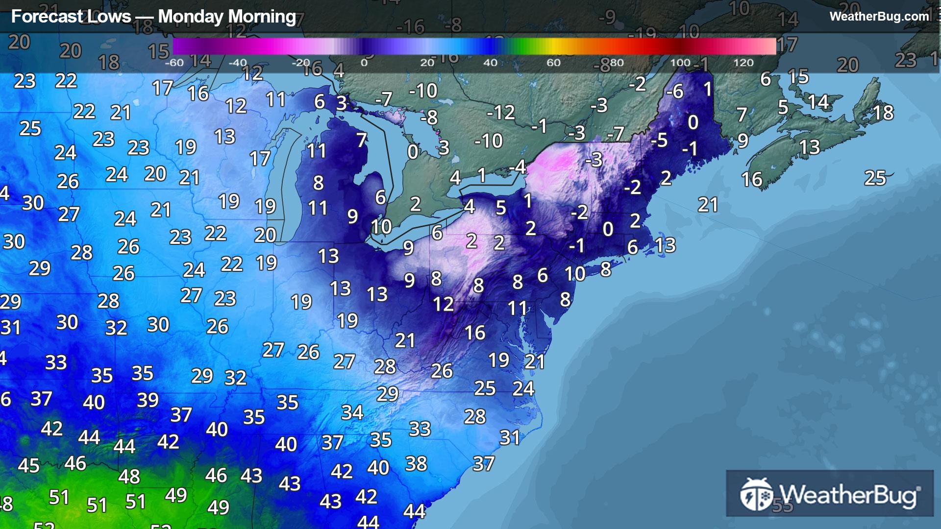
In the wake of the snowstorm that tracked across the Eastern U.S. earlier this weekend, a polar air mass has halted over the eastern third of the nation. As a result, temperatures will be as much as 40 degrees below normal!
Temperatures tonight and early Monday morning will fall into the low teens and single digits across the Mid-Atlantic, the New York metropolitan area, and the New England coast. Much of central Appalachia and the New England interior will sink below zero and into the negative single digits and negative teens, with localized areas dropping into the negative 20s in the Adirondacks and northern ridges of Appalachia.
On top of the sheer cold, the switch between low and high pressure will continue to provide breezy winds across the Northeastern U.S tonight and into the morning, amplifying the cold with even lower wind chills. The coldest wind chill values will occur Monday morning, which will drop to the teens and single digits from North Carolina’s beaches and mountains into northern Virginia. It will feel below zero into the negative teens across central Appalachia, the Northeast’s urban areas, the low-lying Hudson River Valley, many other valleys across New England, and through southern and eastern Maine. Bitter negative 20s and localized negative 30s will quickly zap heat across the Adirondacks and northern Appalachia.
Even without factoring in the wind, temperatures will still be so cold that many daily low temperature records could be broken. Thankfully for the Eastern U.S., temperatures are expected to rise through mid-week.
Extreme Cold Warnings and Cold Weather Advisories are in effect across parts of the Northeast. The combination of winds and very low temperatures will produce life-threatening wind chills.
It cannot be understated how dangerous the cold will be, as frostbite can set in on exposed skin in 30 minutes or less. If you have to venture outside, dress in layers, being sure to cover up any exposed skin. Also, you can prevent water pipes from freezing by wrapping them or allowing them to drip slowly throughout the day.
Be sure to keep up with the latest watches and warnings from your local weather sources or by downloading the WeatherBug app. Stay warm!