Back to forecast
Rocky Mountains Bracing For Plate of Thanksgiving Snowfall
November 22, 2023 at 08:06 PM EST
By WeatherBug Meteorologist, Mark Paquette
A cold area of Canadian high pressure will drop southward while an upper-level disturbance will pass over the Rocky Mountains and cause snow around the Thanksgiving holiday.
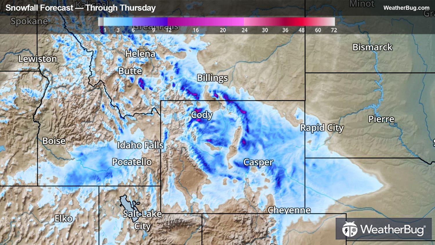
Currently, Winter Storm Warnings stretch across much of Wyoming as well as adjacent parts of Colorado, Nebraska and Montana. Winter Weather Advisories are in effect much of the rest of the northern and central Rockies from Montana to Colorado. This includes the Interstate 25 corridor in Colorado and Wyoming, as well as the Interstate 90 corridor across Wyoming and Montana. Winter Storm Watches are found for west-central Nebraska, northwestern Kansas and far eastern Colorado.
A disturbance gliding southward from Canada will get going on Thanksgiving as it moves inland. The highest accumulations will be in the higher terrain of the Rockies, where 5-10 inches of snow is expected. Lesser amounts are likely closer to the Interstate 25 corridor, with 2-5 inches of accumulation on Thursday into Friday.
By Friday, a trip to the mall will be a snowy one across Colorado and the High Plains. The developing storm’s interaction with colder air will allow it to accumulate from Denver to Goodland, Kan. By Saturday, this disturbance will continue to drop southeast and will be centered over the southern and central Plains. Leftover light snow will likely continue to be experienced in the San Juan and Sangre De Cristo Mountains of Colorado and New Mexico. Dodge City, Garden City and Hays, Kan., could see a few inches of snow to interfere with people’s travel or shopping plans.
Make sure to follow WeatherBug by downloading the app to stay up to date on the latest watches/advisories for this storm.