


Scorching Heat Wave Sizzles In The Central U.S.
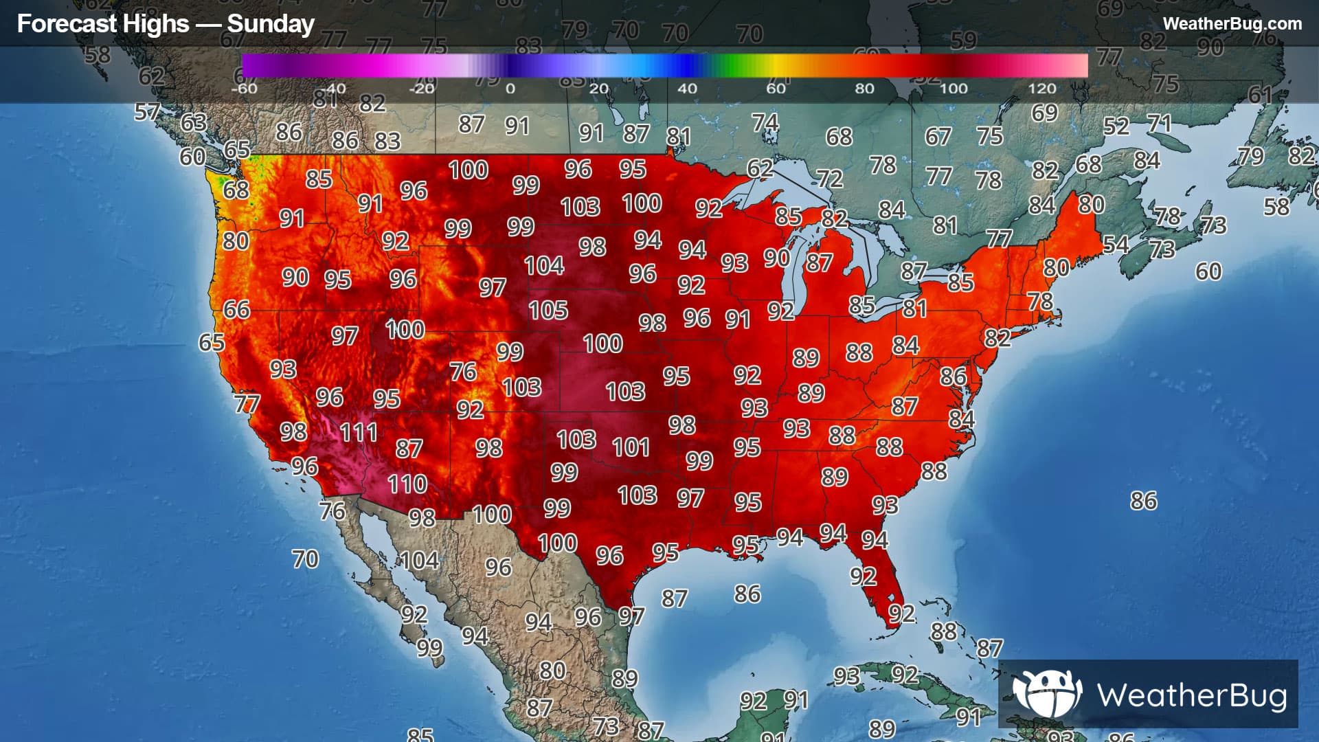
A heat dome is bringing scorching temperatures to the Central U.S. as the weekend ends and the workweek begins.
A large area of high pressure aloft will remain anchored over the Central U.S. for the next few days. This will lead to dry and hot weather, allowing highs to skyrocket into the 90s and triple-digits each afternoon.
The hottest days will be today and Monday, when temperatures could hit the 110-degree mark. Thanks to oppressive humidity, widespread heat indices, or feels-like temperatures, will range from near 100 to locally as much as 120 degrees!
Even in the overnight hours, relief from the heat will be difficult to find. Temperatures will only fall into the 70s and 80s. Warm low temperatures such as these when combined with high humidity can lead to an increased risk of heat-related illness, and could have an impact to power, water, and transportation systems.
Extreme Heat Warnings and Heat Advisories are in effect throughout the nation's midsection. This includes areas from Montana, southeastern Idaho, Utah, and New Mexico eastward to Wisconsin, western Illinois, far southern Indiana, western Kentucky and Tennessee, most of Alabama and the Florida Panhandle. This also includes the central Gulf Coast and southern Plains northward to the U.S.-Canadian border. Major metro areas under fire include Dallas, Oklahoma City, Kansas City, St. Louis, Denver, Minneapolis, and Memphis.
If you are in one of these areas experiencing extremely hot temperatures, it is exceptionally important to stay hydrated and cool. Avoid exposure to the sun from late morning into the early evening. Make sure to take frequent breaks in the air conditioning or shade, eat and dress lightly, and to use sun protection if outdoors. Always check the back seat before exiting your car, as a vehicle can reach 30 to 40 degrees higher than outdoor temperatures. Never leave kids or pets unattended and remember to “Look Before You Lock!”