


Severe Storms Fire Up Across Southeast and Southwest
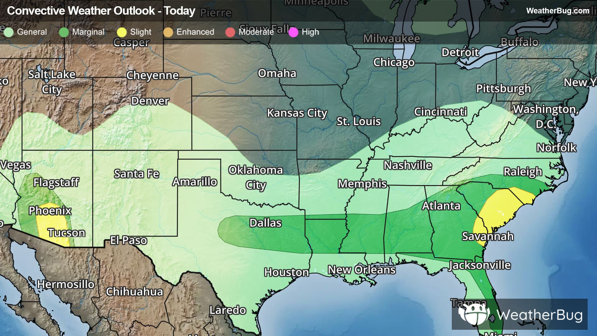
Strong to severe thunderstorms will remain possible this evening across parts of the Carolinas, eastern Georgia and southern Arizona, while flooding concerns persist from parts of the Tennessee Valley into the central Appalachians.
A slow-moving disturbance and cold front will continue to trigger thunderstorms across southern North Carolina, South Carolina and far eastern Georgia through this evening. Warm, humid air and favorable atmospheric conditions will support the risk for damaging wind gusts, torrential downpours and isolated hail. The greatest concern for severe weather will be across eastern South Carolina, southeastern North Carolina and far eastern Georgia. The Storm Prediction Center has issued a Slight Risk (Level 2 of 5) for severe thunderstorms across the region. Cities included in the risk area include Columbia and Charleston, S.C., Savannah, Ga., and Wilmington, N.C. While the severe threat should gradually diminish later this evening, a few storms may still be capable of producing damaging winds.
In the Desert Southwest, monsoonal moisture remains firmly in place across southern and central Arizona. Thunderstorms developing this evening will have the potential to produce damaging wind gusts, torrential rainfall and hail. Dry air near the surface and steep temperature changes with height may enhance the risk for powerful downburst winds as storms move westward across the region. A Slight Risk (Level 2 of 5) for severe thunderstorms remains in effect for parts of southern Arizona, including Phoenix and Tucson.
Meanwhile, a slow-moving disturbance will continue to bring rounds of showers and thunderstorms from Kentucky and Tennessee into far southern Ohio, parts of West Virginia and southwestern Virginia. Additional rainfall totals of 1 to 3 inches are expected, with locally higher amounts possible where storms repeatedly track over the same locations. This may lead to renewed flooding concerns, especially in areas that have already received significant rainfall. As a result, Flood Watches remain in effect across parts of the region.
Make sure to know the difference between a watch and a warning should they be issued. A "watch" means that conditions are favorable for severe weather to occur, and to be on alert for any rapidly changing conditions. A "warning" means that severe weather is imminent, and you should act fast to remain safe.
The best way to remain safe is to stay prepared and informed about your local weather. Have a severe weather kit packed with a battery-operated radio, water, and non-perishable food items. Also, check the WeatherBug app frequently for any updates on today's severe weather. Remember, "When Thunder Roars, Go Indoors!"