Severe Storms Ignite Across the Northern Rockies
A strong and vigorous disturbance will cause strong to severe thunderstorms to develop across the northern Rockies today, primarily in the afternoon and evening.
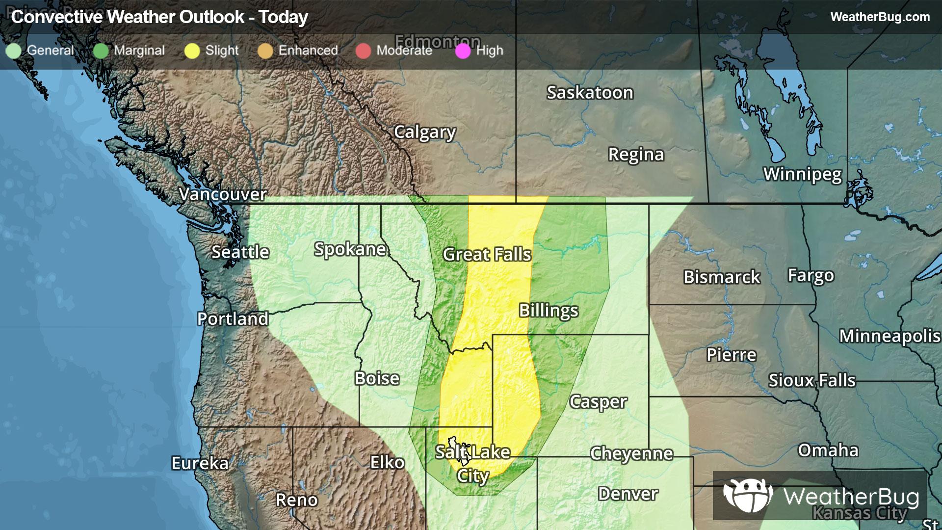
Thunderstorms will form due to an approaching cold front across Idaho, Montana, northern Utah and Wyoming. The main threat from these thunderstorms will be strong wind gusts, but hail will also be a possibility. Wind gusts of up to 60 to 75 mph will be possible in the strongest thunderstorms.
The government's Storm Prediction Center has issued a Slight Risk, a 2 out of 5 on the severe probability scale, for parts of eastern Idaho, northern Utah, western Montana and western Wyoming. This includes Salt Lake City and Great Falls, Mont.
Make sure to know the difference between a watch and a warning should they be issued. A watch means that conditions are favorable for severe weather to occur, and to be on alert for any rapidly changing conditions. A warning means that severe weather is imminent, and you should act fast to remain safe.
The best way to remain safe is to stay prepared and informed about your local weather. Have a severe weather kit packed with a battery-operated radio, water, and non-perishable food items should you be without power for long periods of time. Also, check the WeatherBug app frequently for any updates on today’s severe weather. Remember, “When Thunder Roars, Go Indoors!”