Back to Hourly Forecast
Dangerous Weather Threatens Western, Northern High Plains
August 5, 2025 at 01:08 AM EDT
Updated By WeatherBug Meteorologist, Dan Rupp
Thunderstorms packing very large hail, damaging wind gusts, and a brief tornado or two, could patrol parts of the western and northern High Plains this afternoon and evening.
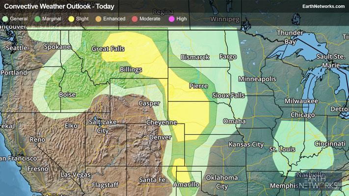
A hot, somewhat humid air mass will team up with a few disturbances aloft, fostering at least a couple waves of thunderstorms across the Great Plains. Individual thunderstorms may develop originally, then will likely converge into lines or clusters by this evening and tonight.
Great Falls and Glasgow, Mont., Rapid City, S.D., Valentine and McCook, Neb., as well as Amarillo, Texas, are some of the bigger cities found in the Storm Prediction Center’s Slight Risk severe weather zone.
The main threat will be damaging wind gusts up to 70 mph and very large hail, although an isolated brief tornado cannot be ruled out. Storm activity may very well last overnight into early Tuesday morning.
Make sure to know the difference between a watch and a warning should they become issued. A “watch” means that conditions are favorable for severe weather to occur and to be on alert for any rapidly changing conditions. A “warning” means that severe weather is imminent, and you should act fast to remain safe.
The best way to remain safe is to stay prepared and informed about your local weather. Have a severe weather kit packed with a battery-operated radio, water, and non-perishable food items should you be without power for long periods of time. Also, check the WeatherBug app frequently for any updates on today's severe weather. Remember, "When Thunder Roars, Go Indoors!"