Severe Storms Rumble Across Texas to the Mississippi Valley
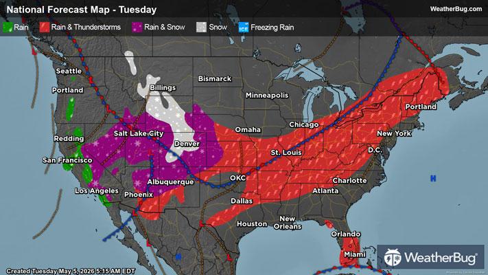
A potent cold front will help spark a round of severe thunderstorms later this afternoon and evening from northeast Texas to western Tennessee.
Seasonably warm and humid conditions will continue to surge northward ahead of this front today. This unstable air mass will collide with a cooler and drier air mass pressing southward from the Upper Midwest and northern Plains. Add in some upper-air energy moving across this front to help lift the air, and scattered strong to severe thunderstorms are likely to develop.
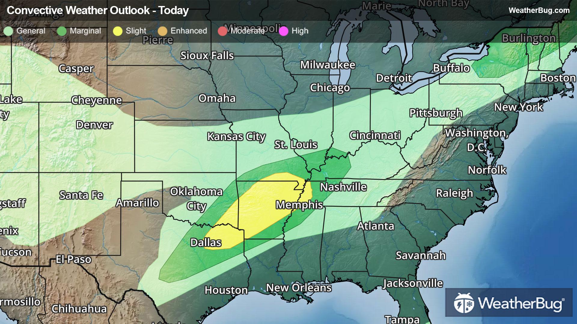
As a result, the government's Storm Prediction Center has issued a Slight Risk, or a 2 out of 5 on the severe weather probability scale, from northeast Texas to southeast Missouri and western Tennessee.
All modes of severe weather are likely today, including damaging winds, large hail, and a few tornadoes. Some cities at risk include Dallas, Little Rock, Ark. and Memphis.
In addition to the thunderstorms, locally heavy rainfall is expected today, especially from northeastern Arkansas and western Tennessee into the Ohio Valley. Localized rain amounts of 1 to 3 inches will be possible, which may result in local instances of flooding. Remember, “Turn Around, Don’t Drown!”
A few gusty thunderstorms will also be possible this afternoon and evening across northern New York to northern Maine. The same cold front will help ignite these thunderstorms, which may impact cities such as Syracuse, N.Y., Burlington, Vt., and Caribou, Maine. Here, the Storm Prediction Center has issued a Marginal Risk, or a 1 out of 5 on the severe weather probability scale, for today.
As the cold front continues to sink southward on Wednesday, severe thunderstorms will be possible from Texas eastward into the Deep South. The Storm Prediction Center has already issued a large Slight Risk from eastern Texas through northern Alabama. Large hail, damaging winds, and tornadoes will all be possible.
Make sure to know the difference between a watch and a warning should they be issued. A "watch" means that conditions are favorable for severe weather to occur, and to be on alert for any rapidly changing conditions. A "warning" means that severe weather is imminent, and you should act fast to remain safe.
The best way to remain safe is to stay prepared and informed about your local weather. Have a severe weather kit packed with a battery-operated radio, water, and non-perishable food items. Also, check the WeatherBug app frequently for any updates on today's severe weather. Remember, "When Thunder Roars, Go Indoors!"