


Severe Storms Spot the Great Plains, Mississippi Basin
Severe weather returns today, focusing further south into the Mid-South, Lower Midwest, and Great Plains.
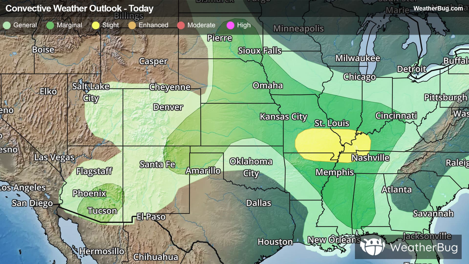
As humid Gulf air infiltrates the heart of the nation, an upper-level disturbance will ignite isolated severe storms. A few severe thunderstorm lines and supercells will be possible, mainly near where the Ohio River reaches the Mississippi River.
The government's Storm Prediction Center has issued a Slight Risk, or a 2 out of 5 on the severe weather probability scale, from southern Missouri and northern Arkansas through western Kentucky and northwestern Tennessee. Cities such as Springfield, Mo., Paducah, Ky., and Evansville, Ind., may observe damaging winds, large hail, and perhaps a tornado or two.
A larger Marginal Risk, a 1 out of 5, expands in southern High Plains and central Plains to the Ohio Valley and western Alabama. Though the tornado risk is largely absent, stray instances of damaging winds or large hail could threaten cities like Omaha, Neb., St. Louis and Kansas City, Mo., Louisville, Ky., Nashville and Memphis, Tenn., Tupelo, Miss., and Tuscaloosa, Ala.
Separately, in southeastern Arizona, very isolated damaging winds may also make a few appearances beneath the strongest monsoonal thunderstorms today. Another Marginal Risk covers this region, including Phoenix and Tucson, Ariz.
Be sure to know the difference between a watch and a warning. A watch means that the conditions are in place to possibly produce severe weather, while a warning indicates that those conditions are currently occurring. Be sure to have multiple ways to receive warnings, as storms will be occurring late tonight. Also, take caution if you are outdoors during a thunderstorm. Remember, “When Thunder Roars, Go Indoors!”