


Severe Thunderstorms Possible Across the Northern Plains
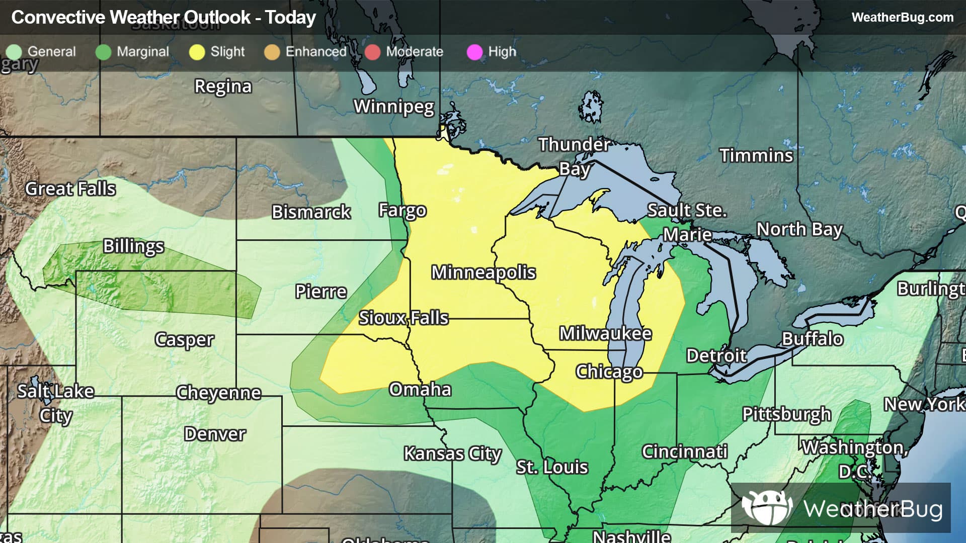
Severe weather may be found across the northern Plains this afternoon, with these storms slowly progressing east and reaching the East Coast by the early to middle part of next week.
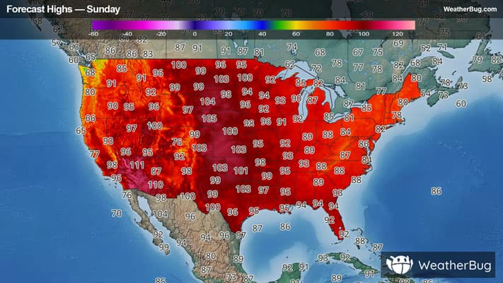
A brutal heat dome continues to be parked over the central U.S., causing dangerously hot temperatures from the Canadian border all the way south to the Gulf Coast and Mexico. Meanwhile, a cold front is moving into the northern Plains this afternoon, bringing with it relief from these scorching temperatures of the past several days.
Strong to severe thunderstorms are expected to develop along and ahead of this front this afternoon and overnight as it pushes southeast into a steamy environment, with the strongest ones expected across southeast South Dakota, Minnesota, northern Iowa, Wisconsin and portions of northern and western Michigan, including the Upper Peninsula. Here, the national Storm Prediction Center has highlighted a Slight Risk (level 2 of 5 on the severe storm scale) of severe storms.
The extremely hot temperatures in place, in some places reaching a scorching 100 degrees this afternoon, are likely to provide the energy needed to cause these quick-developing storms. These thunderstorms could contain strong wind gusts of 60 to 80 mph. In addition, hail and a few tornadoes are also possible.
This cold front will continue to progress southeastward over the beginning part of the new workweek. Severe weather will be possible across the Great Lakes Monday, the Mid-Atlantic on Tuesday and New England on Wednesday.
Be sure to know the difference between a watch and a warning. A watch means that the conditions are in place to possibly produce severe weather conditions, while a warning indicates that those conditions are currently occurring. Also, take caution if you are outdoors during a thunderstorm. Remember, “When Thunder Roars, Go Indoors!”