
Severe Weather Sweeps East Coast, High Plains
Severe weather ignites today from both an intense cold front from Georgia to Vermont as well as daytime heating in the southern High Plains.
The same low pressure system that wrought destructive winds, hail, and tornadoes in the Midwest on Wednesday and Thursday will shift northeastward into Canada today. However, its cold front will continue to sweep eastward, eventually reaching the Atlantic coastline this evening.
Abnormally hot and humid air preceding the front will lead to plenty of instability in the atmosphere, which will feed into the thunderstorm line’s strength and the intensity of its damaging gusts. Areas from the Appalachians to the Mid-Atlantic and far western New England could observe widely scattered gusts of 50 to 60 mph or greater.
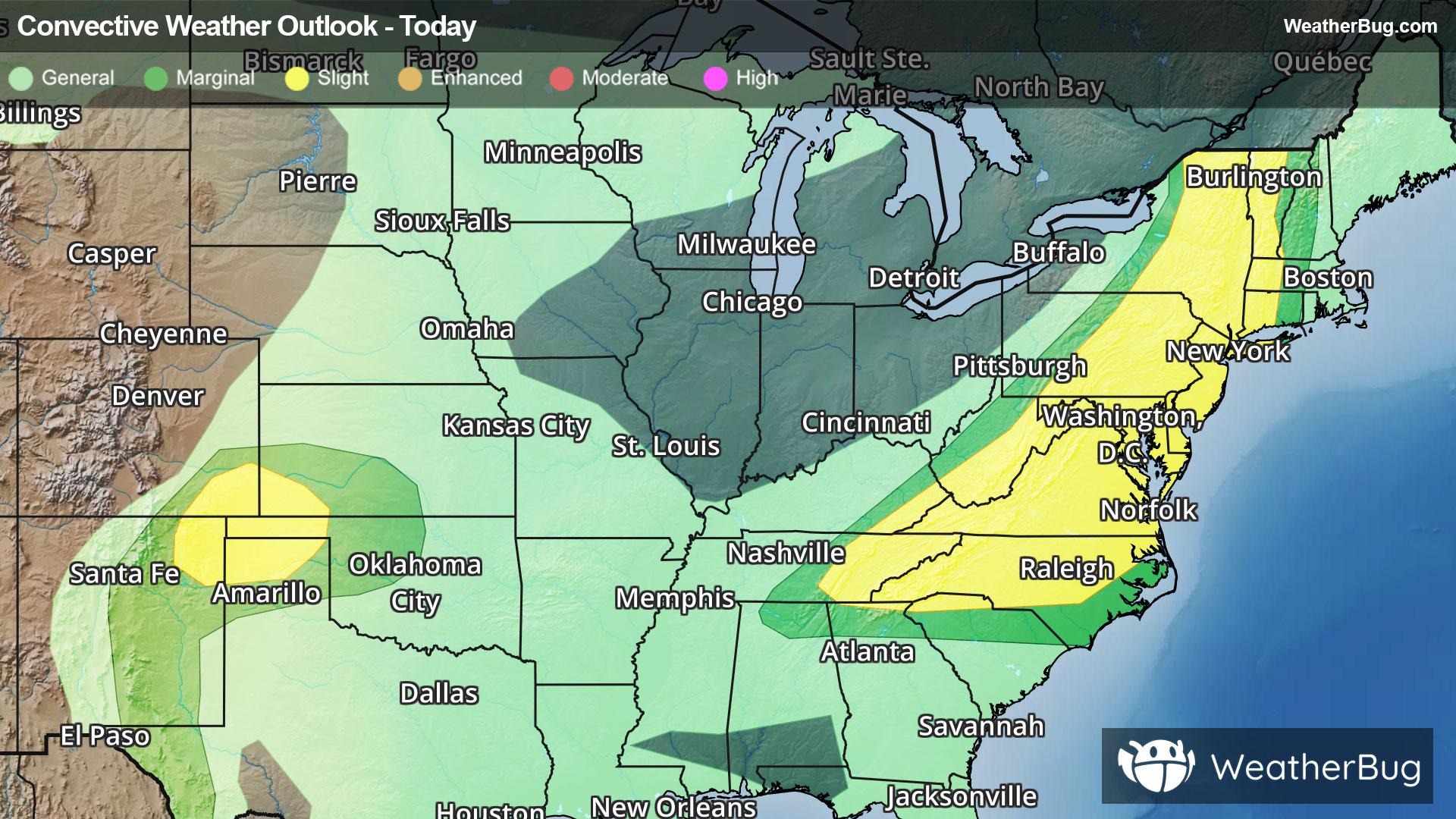
Spanning from the Georgia-South Carolina border through southwestern New England, the government’s Storm Prediction Center has issued a Slight Risk, a 2 out of 5 on the severe weather probability scale. Metropolitan areas at risk include Knoxville, Tenn., Charlotte and Raleigh, N.C., Virginia Beach and Richmond, Va., Washington, D.C., Baltimore, Philadelphia, and New York City.
Separately, another much smaller Slight Risk has been posted for parts of the southern High Plains. Here, thunderstorms launched by slow but steady daytime heating will have the ingredients to brew isolated supercells and severe thunderstorm clusters. Towns including Clayton, N.M., Guymon, Okla., Lamar, Colo., and Liberal, Kan., could observe severe thunderstorms capable of damaging winds, large hail, and even a tornado or two.
Make sure to know the difference between a watch and a warning should they be issued. A "watch" means that conditions are favorable for severe weather to occur, and to be on alert for any rapidly changing conditions. A "warning" means that severe weather is imminent, and you should act fast to remain safe.
The best way to remain safe is to stay prepared and informed about your local weather. Have a severe weather kit packed with a battery-operated radio, water, and non-perishable food items. Also, check the WeatherBug app frequently for any updates on today's severe weather. Remember, "When Thunder Roars, Go Indoors!"