Severe Weather Tracks Across the Southeast
Severe weather is unusual in the middle of winter, but ingredients will come together to produce stormy weather over the southeastern U.S.
Currently, there is a Tornado Watch for north-central Florida.
A low pressure system tracking across the Gulf states will carry moisture and energy to aid in the development of severe thunderstorms through much of the day today. This is the same weather system that produced a few tornadoes in Louisiana on Saturday along with dozens of high wind reports.
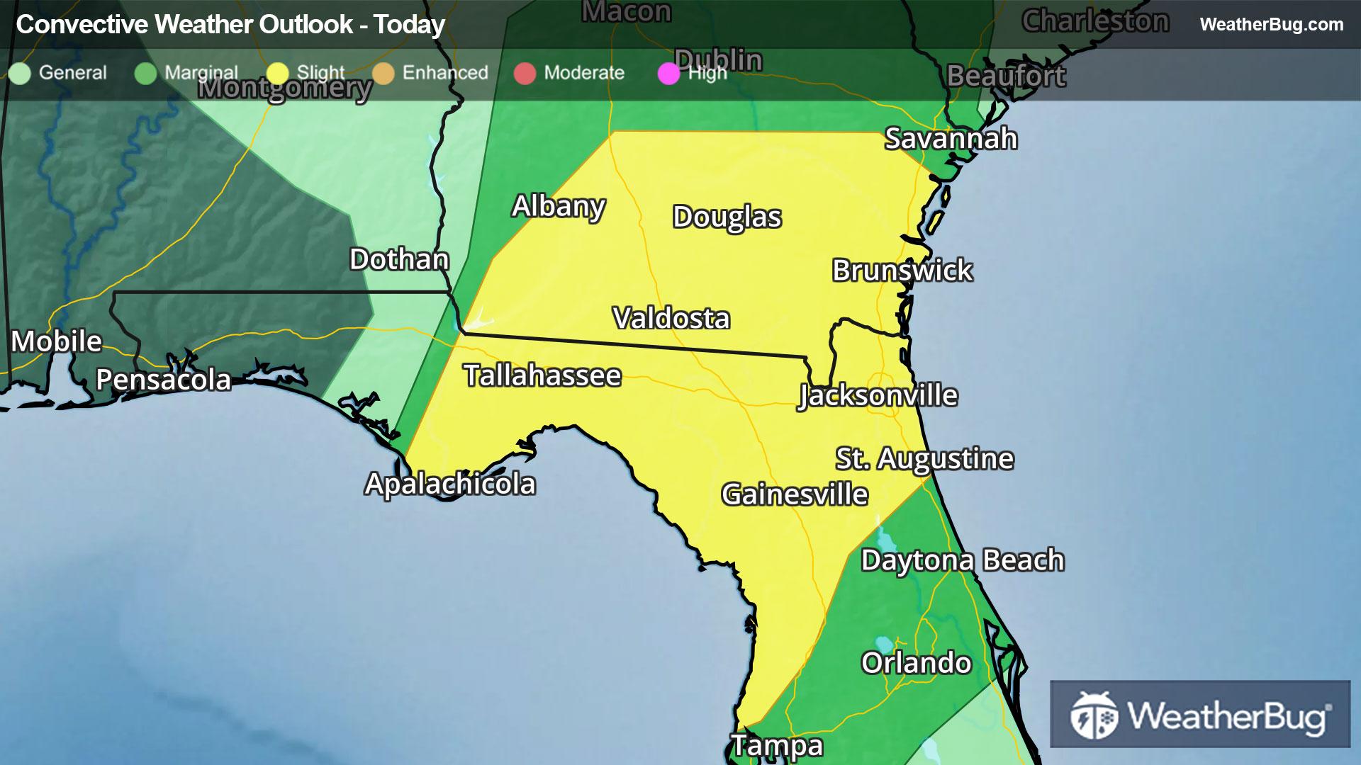
The Storm Prediction Center has overlayed a Slight Risk for severe thunderstorms for southern Georgia and northern Florida. Cities included are Albany and Brunswick, Ga., and Gainesville, Tallahassee, and Jacksonville, Fla. The main threats will be damaging winds and a few tornadoes, but some large hail cannot be ruled out.
This weather maker will also bring the possibility of localized flash flooding across the Southeast as well. Heavy rain could accumulate 1 to 2 inches by daybreak Monday.
Thunderstorms will likely make it to central Florida during the overnight hours, but should weaken once they move past Orlando and Tampa, Fla.
The best way to remain safe is to stay prepared and informed about your local weather. Have a severe weather kit packed with a battery-operated radio, water, and non-perishable food items should you be without power for long periods of time. Also, check the WeatherBug app frequently for any updates on today's severe weather. Remember, "When Thunder Roars, Go Indoors!"