Back to forecast
Severe Storms Rumble Across Dixie Alley
January 9, 2026 at 03:31 AM EST
By WeatherBug Meteorologist, Dan Rupp
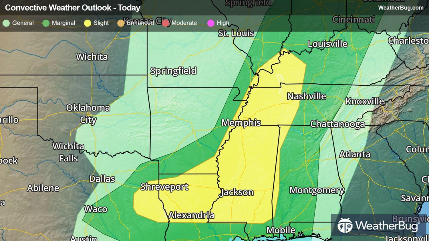
Several ingredients will come together to produce explosive storms from the Ark-La-Tex region to the Mid-Mississippi Valley.
A Tornado Watch is in effect for portions of eastern Louisiana and central Mississippi
An upper level disturbance, cold front, and Gulf moisture will all merge to create harsh thunderstorms. All severe hazards will be possible, from large hail to damaging winds and even a few tornadoes.
Thunderstorms will remain strong to severe well into the overnight hours as the squall line progresses eastward east of the Mississippi River before finally weakening by sunrise.
Make sure to know the difference between a watch and a warning should they become issued. A watch means that conditions are favorable for severe weather to occur and to be on alert for any rapidly changing conditions. A warning means that severe weather is imminent, and you should act fast to remain safe.
The best way to remain safe is to stay prepared and informed about your local weather. Have a severe weather kit packed with a battery-operated radio, water and non-perishable food items should you be without power for long periods of time. Also, check the WeatherBug app frequently for any updates on today’s severe weather. Remember, “When Thunder Roars, Go Indoors!”