Spring Weather Hazards: Excessive Heat to Blizzards
As Mother Nature tries to balance the remaining Arctic chill with expanding subtropical heat thanks to increasing daylight, weather hazards multiply in the spring.
Flooding is nothing new to the Northwest this winter. Rainfall in Seattle was above average in January with 7.06 inches. Just six days into the year, the Willapa River crested dangerous close to major flood stage, inundating many homes in the Willapa Hatchery at Fort Creek area with high water.
Flooding continues to be a major concern in the Northwest through spring while heavy snow has been known to invade the Cascades well into April and May. During warmer episodes later in the spring, the large quantity of water in the snowpack in the Cascades combined with rain can even trigger landslides.
The Southwest has been known to see boiling temperatures from March to the end of May. While the average high temperature in March is still a pleasant 78 degrees in Phoenix, it quickly jumps into the middle 90s by May. Phoenix has been known to reach well into the lower 100s in May, with record highs as recent as 2017 hitting 108 degrees within the May’s first week.
Just two years ago on May 6, a fierce heat wave hit the Southwest with Phoenix reaching a record 106 degrees while Las Vegas climbed to a record 101 degrees. As a matter of fact, starting one day prior on May 5, 2020, Phoenix had a streak of seven consecutive days with highs at or above 100 degrees. Early-season heat waves can be the most stressful since the body is not acclimated to those conditions right off the bat.
Sizeable storm systems often develop in the Plains in the spring and bring a rash of weather hazards. Gusty winds brought on by large pressure and temperature changes across cold fronts can fuel wildfires from the Front Range to the southern Plains. This year’s fire danger is elevated more due to the expansion of moderate to exceptional drought in the southern Plains.
On average, the wildfire season reaches its peak in the southern Plains in March and April. In recent memory, the spring of 2016 and 2017 saw wildfires burn more acres in Oklahoma and Kansas than any other year prior. A classic example of the devastation with wildfires occurred March 6, 2017 when 32 major fires burned 1.3-million acres. Another example in recent memory was the Starbuck fire that ignited on the Oklahoma and Kansas border in early March of 2017. This wildfire alone burned more than 600,000 acres.
Farther north, the northern Plains, Great Lakes to northern Mid-Atlantic and Northeast are prone to blizzards and Arctic outbreaks. Historically, March is the most favored spring month for blizzards and they typically develop over the Southwest before undergoing rapid development east of the Rockies. Most blizzards then track into Minnesota before exiting into Canada.
One of the most memorable northern Plains blizzards occurred in early March of 1966. Twenty to 30 inches of snow blasted the Dakotas with winds up to 70 mph. At least 18 people died in the storm and tens of thousands of livestock perished. Transportation was impossible and power outages remained for days. This storm is a prime example of the hazards associated with spring northern Plains blizzards. Frigid weather often follows blizzards, with subzero temperatures sweeping in behind the early March 1966 blizzard. Hypothermia can happen very quickly, and pipes are prone to bursting during major cold outbreaks.
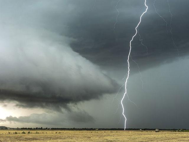
Not to be outdone, spring severe weather ramps up very quickly in the South between March 1 and the end of May. Historically, the highest chance for tornadoes, hail and destructive thunderstorm winds occurs in mid-to-late May across the central and southern Plains. Other favorable spots for destructive storms by late spring include the Midwest, Ohio Valley and southern Appalachians. Just last year alone, spring severe weather triggered three billion-dollar weather disasters from Texas to the Southeast.
Take all severe weather warnings seriously and keep a battery-operated NOAA weather radio fully charged this spring season. It’s especially important to have a NOAA weather radio turned on while you are sleeping if your area is at risk for an overnight severe weather outbreak. Thunderstorms and tornadoes are responsible for loss of lives, crops and billions of dollars of destruction.
As spring gets underway across the U.S., keep ahead of the severe weather threat, heat wave or major winter storm with WeatherBug and download the WeatherBug app to get the latest hourly to extended forecast for your area.
---
Story Image: A thunderstorm is seen in the Plains. (Courtesy of Pixabay.com)