
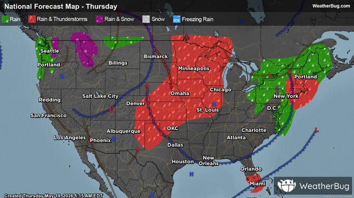
Storms Erupt Across the Plains
A disturbance will move across the southern and central Plains today, causing strong to severe thunderstorms to develop this afternoon and tonight.
Thunderstorms will form across parts of northwestern Texas up into Kansas, Missouri, far southern Iowa, and southern Nebraska. The primary risks from these thunderstorms will be damaging wind gusts and hail. An isolated tornado or two cannot be ruled out in the strongest thunderstorms. Wind gusts up to 60 to 75 mph will also be possible.
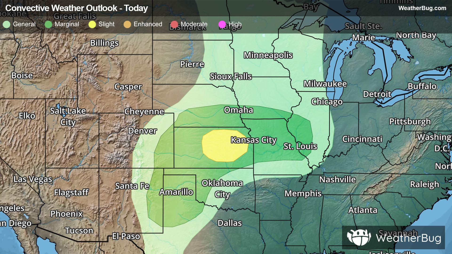
The government's Storm Prediction Center has issued a Slight Risk, a 2 out of 5 on the severe probability scale, for parts of central and eastern Kansas. This includes the cities of Wichita and Topeka. A Marginal Risk, a 1 out of 5 on the severe probability scale, has been issued for far eastern New Mexico, northwestern Texas, western Oklahoma, Kansas, southern Nebraska, far southern Iowa, and Missouri. This includes St. Louis and Kansas City, Mo. all the way down to Amarillo, Texas.
Make sure to know the difference between a watch and a warning should they be issued. A watch means that conditions are favorable for severe weather to occur, and to be on alert for any rapidly changing conditions. A warning means that severe weather is imminent, and you should act fast to remain safe.
The best way to remain safe is to stay prepared and informed about your local weather. Have a severe weather kit packed with a battery-operated radio, water, and non-perishable food items should you be without power for long periods of time. Also, check the WeatherBug app frequently for any updates on today’s severe weather. Remember, “When Thunder Roars, Go Indoors!”