Back to forecast
Strong Storms Threaten Plains, Upper Midwest
October 11, 2022 at 07:47 PM EDT
UPDATED by WeatherBug Meteorologists
The calendar may read October, but that will not stop spotty severe thunderstorms from erupting in the nation’s midsection tonight.
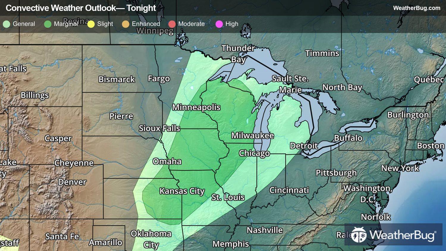
These storms are expected to develop along a strong cold front that will track across the Midwest and Great Lakes through Midweek before pushing toward the East Coast on Thursday.
The strong thunderstorms will continue this evening from Minnesota and Wisconsin to Iowa and Kansas. Even once the sun has dipped below the horizon, storms will continue marching into northern Illinois and Missouri, possibly impacting cities such as Kansas City, Mo., and Wichita, Kan.
While this is by no means expected to be a major outbreak of severe weather, a few damaging wind gusts of 45-60 mph, hail up to the size of pennies or quarters, and brief blinding rain are possible in any thunderstorms that develop.
If you need to be out and about today, be sure to keep a close eye on the weather. Understand the difference between a weather watch and a warning. A watch means that an area is being monitored for dangerous weather. A warning means that dangerous weather is imminent, and it is time to move to a safe, secure location, as close to ground level as possible and away from windows to the outdoors.
Keep in mind that lightning is one of Mother Nature's most dangerous killers. If you can hear thunder, you are close enough to the storm to be struck by lightning, even if the sun is shining. Also remember, "Turn Around, Don't Drown" when approaching flooded roadways.
Be sure to download the WeatherBug smartphone application so you can check the latest watches and warnings. The app also includes Spark, which tells you where the nearest lightning is so you can quickly get to safety before a storm arrives.