Back to forecast
Big Thunderstorms Pepper Southern Plains to Gulf Coast
May 28, 2024 at 09:55 PM EDT
Updated By WeatherBug Meteorologist, Fred Allen
The calendar can’t seem to flip to June fast enough to get a fresh start as dangerous weather will remain a problem across the southern Plains through early Wednesday morning.
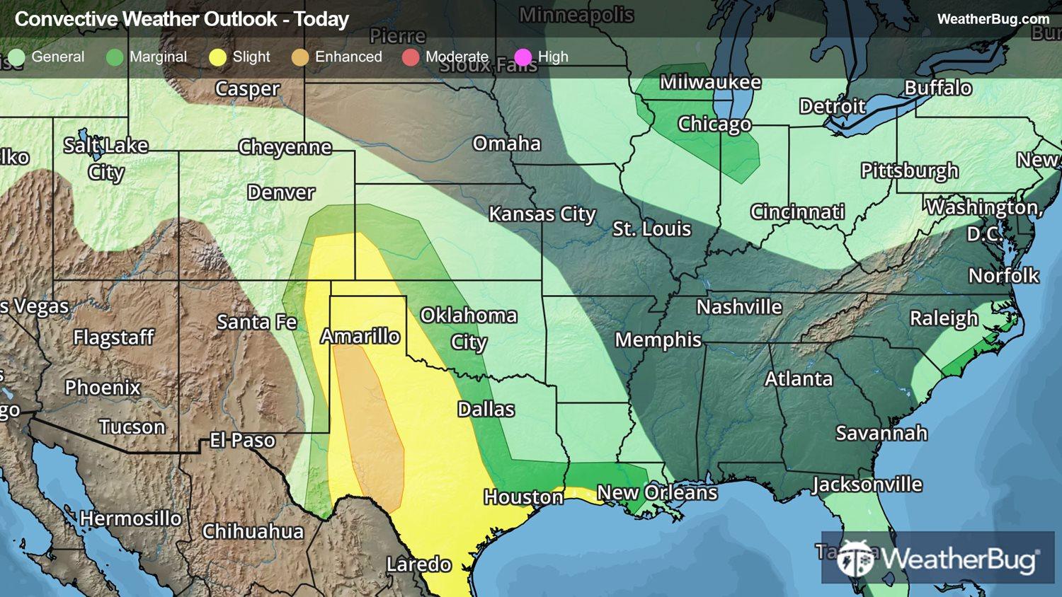
Thunderstorms scattered about have already exploded in the vicinity of a dryline across Texas from the Panhandle to near the Big Bend area. This activity will pivot east and southeast, potentially merging into clusters this evening through predawn on Wednesday. A few peppy thunderstorms have also developed across far southeastern Colorado and the Oklahoma Panhandle as well.
Severe Thunderstorm Watches are in effect from far southeastern Colorado and southwestern Kansas to the Texas Panhandle and eastern New Mexico, as well as across southwestern Texas. Midland, San Angelo, Sanderson, Del Rio, Amarillo, Laredo and McaAllen Texas, Clayton, Tucumcari, and Clovis, N.M., are all included.
A Tornado Watch is in effect across western Texas, including Lubbock and Childress.
A few more pockets of potentially potent thunderstorms may pepper the northern Rocky Front Range and southern Wisconsin to northwestern Indiana, a small part of eastern North Carolina, and northern/eastern Maine. The primary risk will be brief gusty winds exceeding 60 mph, although instances of hail cannot be ruled out either.
There have been nearly 100 severe weather reports covering far southeastern Colorado and Kansas to southeastern Texas and southwestern Louisiana throughout today. A vast majority have been damaging wind gusts, including a clocked 86 mph gust near Double Oak, Texas, this morning. Early this afternoon, Houston’s Bush Intercontinental Airport measured a gust of 75 mph. Near baseball size hail pelted a community near Needmore, Texas, with similar size hail falling in Ashland, Kan., just before Noon today.
Make sure to frequently check WeatherBug for updates, as a watch can quickly turn into a warning upon imminent danger. It is important to stay prepared for active weather. Make sure you know the difference between a watch and a warning should they become issued. A watch means that conditions are favorable for severe weather to take place, whereas a warning means severe weather is imminent and you need to act fast to prevent damage to property or even loss of life. Remember, “When Thunder Roars, Go Indoors!”