The Science of Santa Ana Winds
A common weather phenomenon in Southern California throughout autumn and winter are the Santa Ana winds.
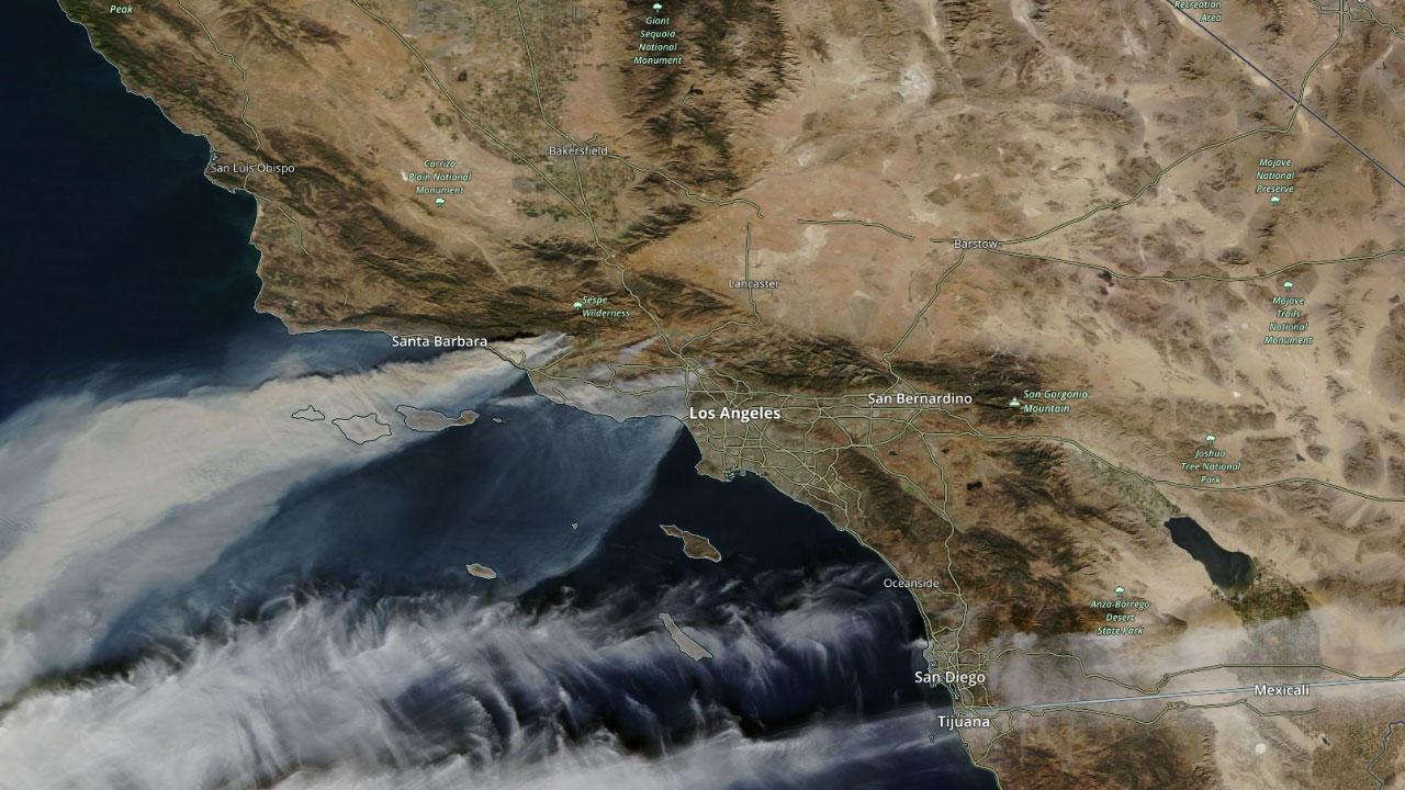
Santa Ana winds are a katabatic wind which refers to a hot and dry wind that blows from interior regions of Southern California towards the coastline. While blowing dust is an occasional side-effect of these winds, the most notable effect of the Santa Ana winds are their ability to quickly spread fires and cause power outages.
The origin of the “Santa Ana” name comes from the fact that these winds blew through the Santa Ana valley, affecting early settlers of the area. A popular misconception is that the winds were named after the Mexican president and general, Antonio Lopez de Santa Ana. Since the winds were referred to as Santa Ana winds before the president became famous, this naming origin has been discounted.
These winds usually occur when a large ridge of high pressure develops over the Great Basin and the upper Mojave Desert in Nevada and interior Southern California. The clockwise wind flow around this high-pressure system brings an east-to-west wind to the highly populated areas between San Diego and Los Angeles.
As these winds surge towards the coastline, they flow down the slopes of the Sierra Nevada, San Gabriel and the San Bernardino mountains. As wind flow pushes down these mountain ranges, the air is compressed. As pressure increases, temperature also increases which results in the air mass warming.
With the compression and warming, much of the moisture is removed from the fast-moving air mass. The relative humidity within these winds often drops below 20 percent. This helps to dry out vegetation in the path of the winds which provides the fuel for wildfires to place. Temperatures often soar into the mid-80s and lower 90s during these events. However, some Santa Ana wind events in winter don't always produce major temperature spikes.
The hot, dry nature of these winds, combined with gusts anywhere from 35 to 55 mph, create a hazardous wildfire potential. The brisk winds tend to quickly fan the flames of any ongoing or developing wildfires, making it difficult for firefighters to get control of the blazes that erupt during Santa Ana wind events. When the Santa Ana winds eventually reach the Pacific Ocean, they usually result in choppy surf conditions along the coastline.
Highest gusts within these winds are often observed during the overnight and morning hours, when the onshore sea breeze is dormant and not acting against the Santa Ana winds.
Story Image: Smoke from wildfires in Southern California being blown across the Pacific during a Santa Ana wind event on December 5, 2017. Source NASA Terra/MODIS.