Back to forecast
Severe Storms Fire From Texas to the Great Lakes
April 24, 2022 at 11:44 PM EDT
UPDATED By WeatherBug Intern Meteorologist, Christopher Smith
A potent cold front swinging through the Central U.S. is firing off strong to severe storms from Texas to the Great Lakes to wrap up the weekend.
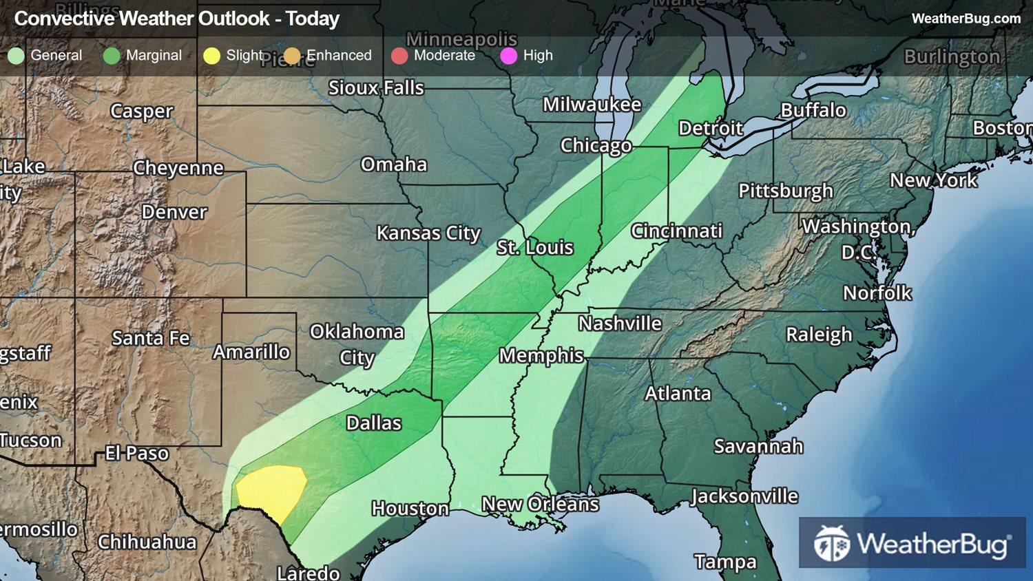
Currently, a line of showers and embedded thunderstorms is stretching along a cold front from northern Texas to the Lower Great Lakes. The main threats with these storms are large hail and damaging wind gusts in excess of 60 mph, although an isolated tornado cannot be ruled out.
There is a Severe Thunderstorm Watch in effect for south central Texas. This includes cities like Del Rio, Ozona and Menard, Texas. Thunderstorms overnight in South Texas could produce wind gusts up to 60 mph, but the primary hazard will be ping-pong size hail.
Temperatures are in the 70s as far north as Michigan with dew points into the 60s, providing plenty of fuel for storms.
On Monday, strong storms may target the Gulf Coast and Midwest as the same cold front pushes farther east.
Be sure to understand the difference between a weather watch and a warning. A watch means that an area is being monitored for dangerous weather. A warning means that dangerous weather is imminent. When a warning is issued, there may be too little time to travel across town or across a county to escape the storm. The time to have a plan of action and move to the general vicinity of a storm shelter or safe area is when a watch is issued.
Keep in mind that lightning is one of Mother Nature's most dangerous killers. If you can hear thunder, you are close enough to the storm to be struck by lightning, even if the sun is shining. Also remember, "Turn Around, Don't Drown" when coming to flooded roadways.
Be sure to download the WeatherBug smartphone application so you can check the latest watches and warnings. The app also includes Spark, which tells you where the nearest lightning is so you can quickly get to safety before a storm arrives.