Back to forecast
Thursday's Weather Outlook
July 12, 2023 at 11:53 AM EDT
By WeatherBug Meteorologist, Mark Paquette
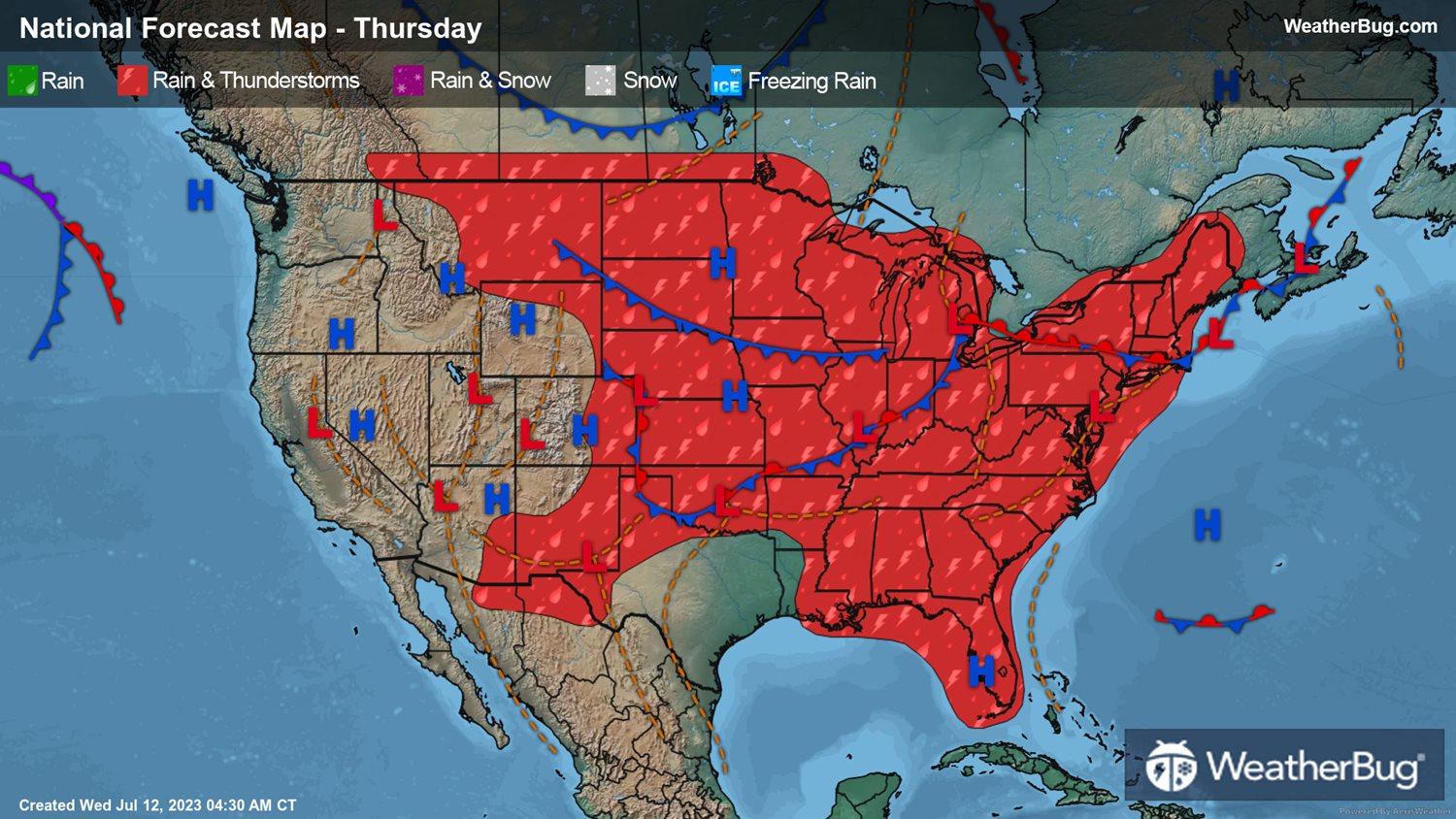
Unrelenting heat will continue Thursday with a huge swath of the country from Texas and Oklahoma westward into the Desert Southwest and finally ending in interior California seeing the mercury in backyard thermometers surging into the triple digits. Even portions of Utah and Colorado will see readings well into the 100s.
Further to the east, a wavy front will be found from New England westward through the Great Lakes into the Central Plains and backed up against the Front Range of the Rockies in Colorado and Wyoming. This front will be the focal point for showers and thunderstorms. This additional rain in eastern New York and Vermont could aggravate the flooding concerns that were so prevalent and damaging just a few days ago.
Along the Ohio River in Pennsylvania and Ohio thunderstorms could become severe, with large hail and strong winds being the most damaging aspect of these thunderstorms. Showers and thunderstorms, being found mainly in the afternoon, will extend southward into the Deep South, the Southeast and Florida. With high temperatures expected to be well into the 90s and high levels of humidity, heat indices will be into the 100s over most of these areas.
West of the Continental Divide, dry weather will be common. In the higher elevations of the Rocky Mountains of Wyoming, Idaho and Montana afternoon high temperatures will be in the 50s and 60s while at the coast 70s will be prevalent. You won’t need to go to far inland to see readings jump into the 80s and 90s. This warmth and continued stretch of dry weather will keep the fire threat rather high for the interior regions of Washington and Oregon.