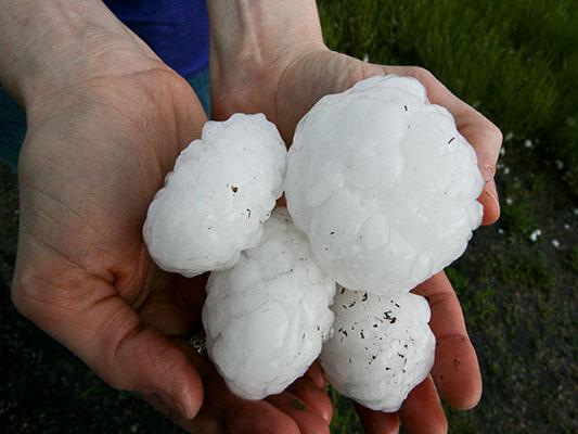
Dangerous Storms Near High, Southern Plains
Several disturbances will trigger severe thunderstorms today across the U.S.
Read MoreSeveral disturbances will trigger severe thunderstorms today across the U.S.
Read More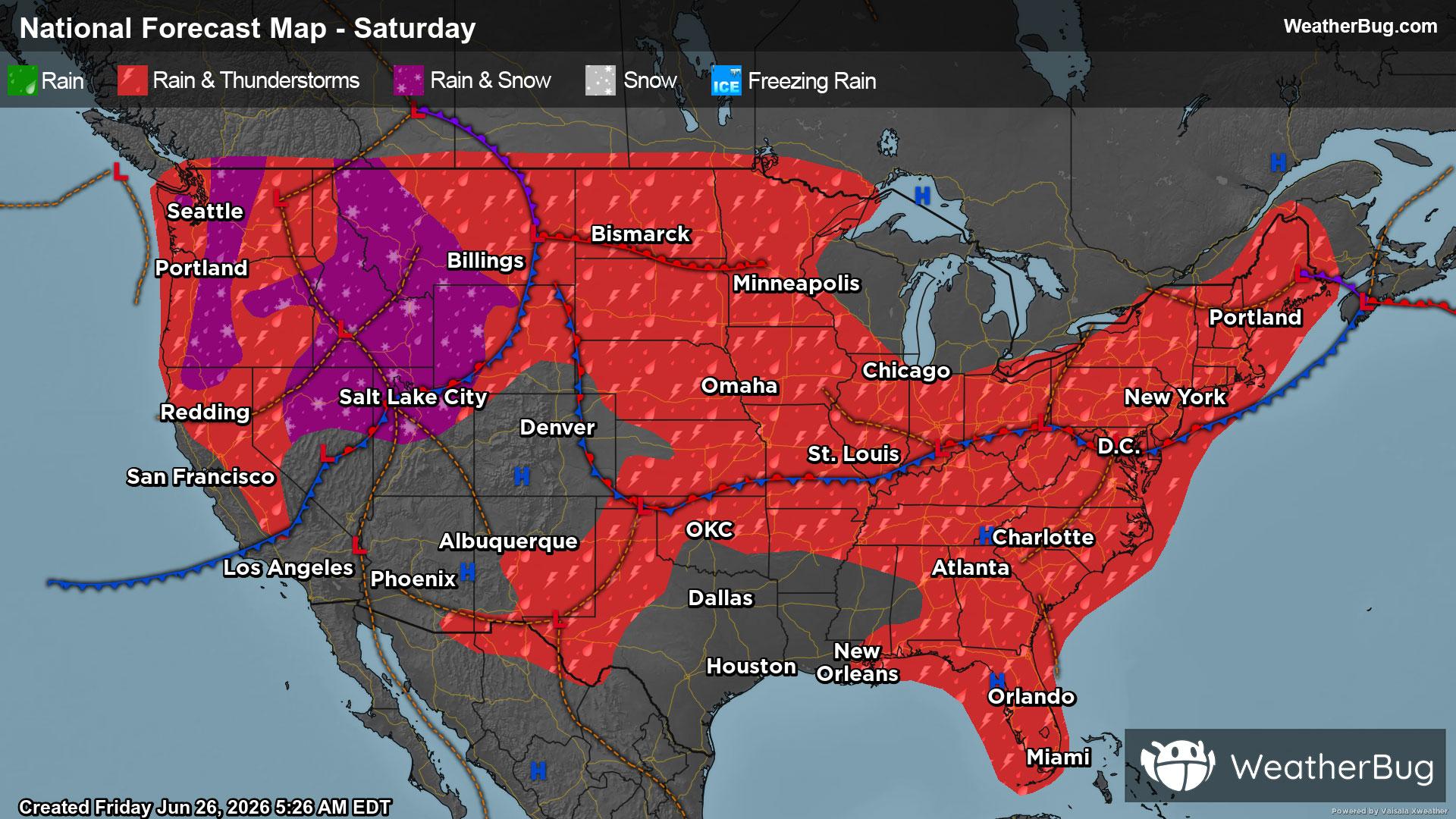
A stormy setup will continue to stretch coast to coast as we go into the weekend.
Read More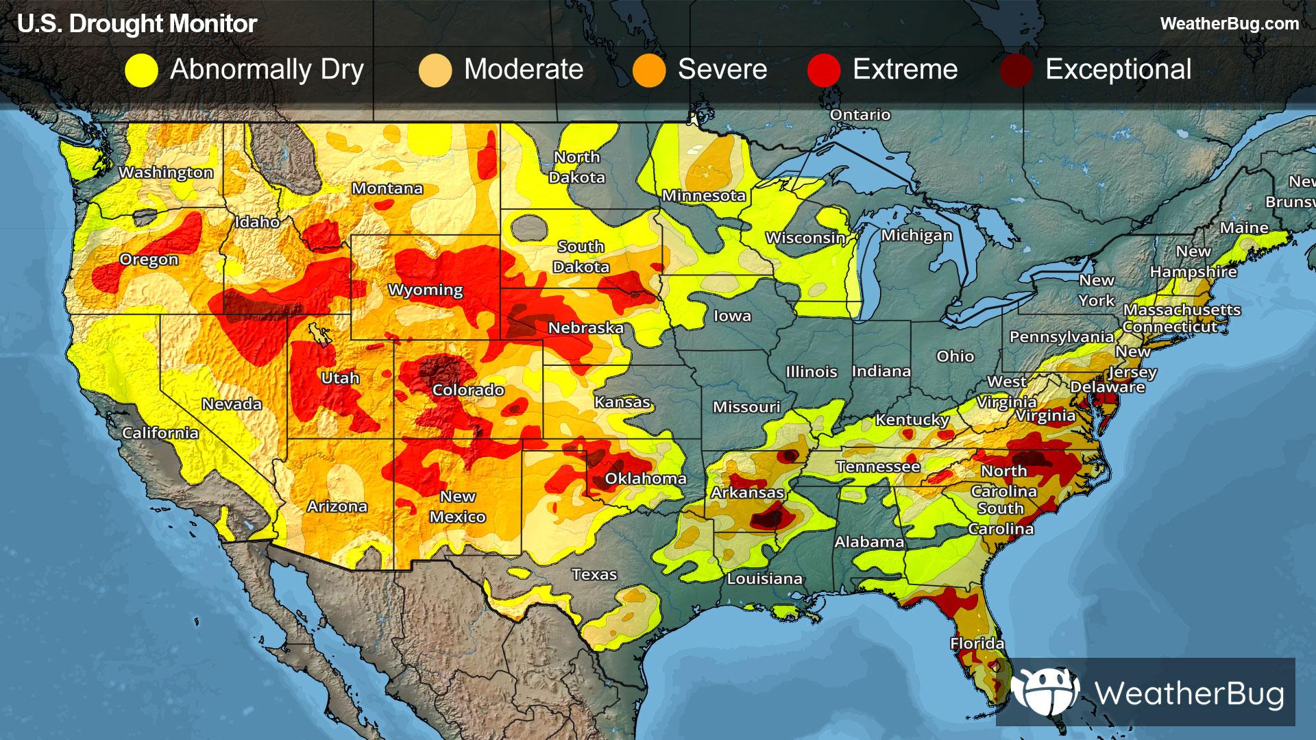
Beneficial rainfall from Tropical Storm Arthur moderated drought in the Deep South
Read More
As this year’s meteorological summer swings in, many folks wonder what might be in store.
Read More