
Sunday's Weather Outlook
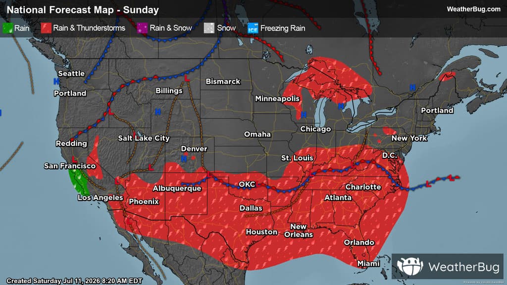
Much of the southern half of the U.S. will be facing scattered showers and storms this Sunday.
Active weather will stretch from coast-to-coast, from the Southwest stretching into the Mid-Atlantic. Early in the day, scattered showers and thunderstorms lingering from the overnight hours will fizzle out over portions of the Desert Southwest, Upper Midwest, Mid-Atlantic, Southeast, and the South-Central U.S.
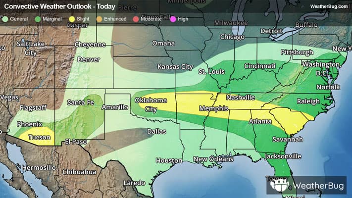
In the afternoon hours, storms will fire up in the Desert Southwest, Upper Midwest, Mid-Atlantic, Southeast, and the South-Central U.S. There is a threat of severe weather, particularly in the Southeast, where storms may bring damaging wind, hail, and even an isolated tornado or two to the region. Remember, the best way to stay safe is to be prepared and informed about your local weather, such as checking the WeatherBug app for any weather updates and that “When Thunder Roars, Go Indoors!”
Isolated showers and even thunderstorms may occur throughout the day on the California Coast and Interior, along with patches of the Northeast.
Meanwhile, the rest of the country can expect clear or partly cloudy skies, as an upper-level ridge of high pressure will expand over much of the U.S.
Temperatures in the 70s and 80s will remain in the forecast across the Lower Midwest into the Mid-Atlantic and Northeast. The Northwest and tallest peaks of the Mountain West will also generally see 70s and 80s. Otherwise, 90s will be widespread throughout the country. Several spots will see triple-digit heat, including California’s Central Valley, the Desert Southwest, Great Basin and northern Plains. Most spots will remain around 100 to 110 degrees, but isolated spots could see highs exceeding 110 degrees. Parts of southern Texas could also see some spots exceed 100 degrees.