
Today's Weather Outlook
Mother Nature has no plans on changing the weather pattern for the start of the work week. Hot, stormy weather will be found throughout much of the nation today, though some spots will miss out on the rain and thunderstorms.
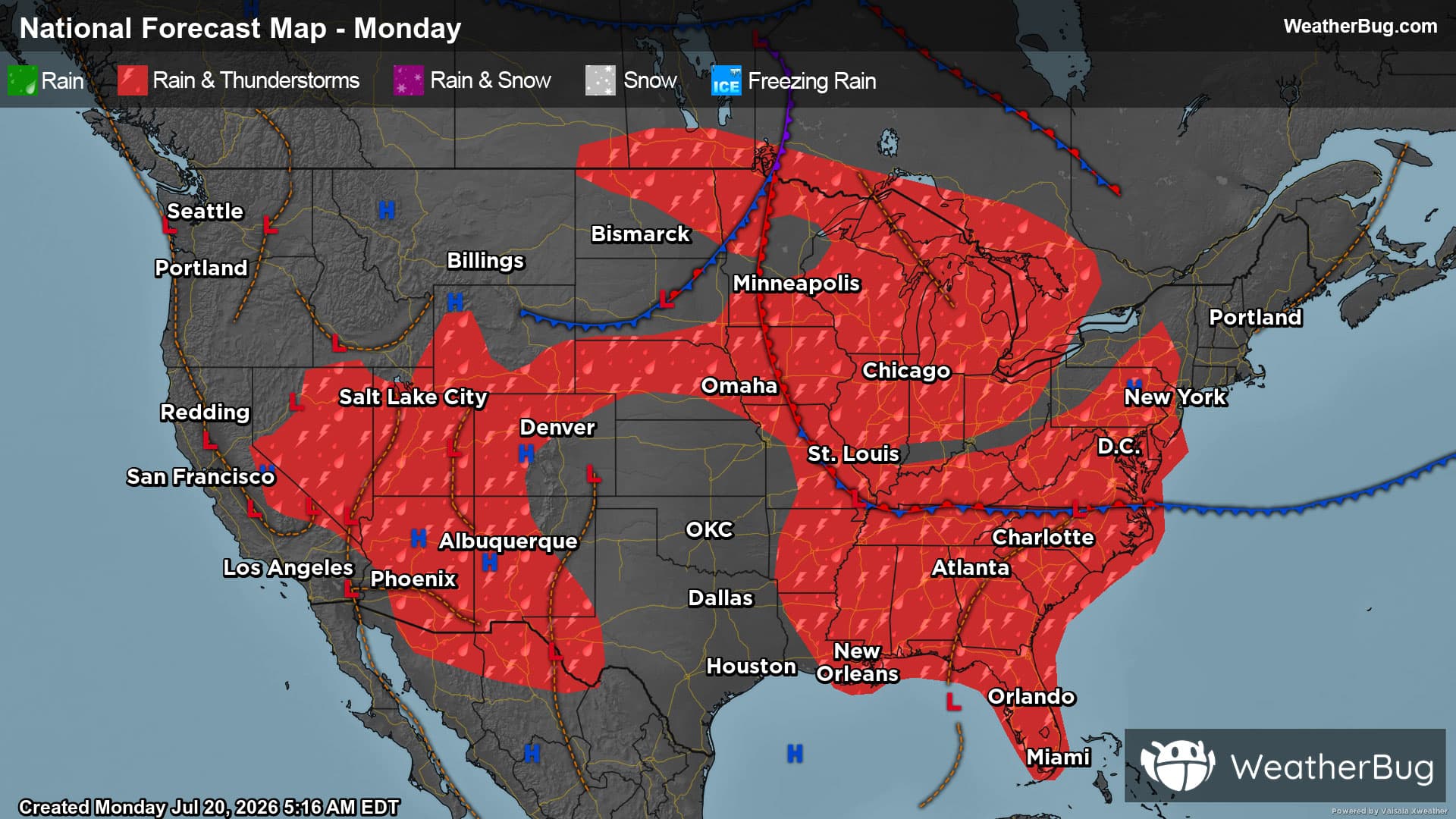
There will be three main weather features across the U.S. today. The first will be a cold front diving south from Canada into the north-central U.S. A “tropical wave,” or a developing low pressure system with tropical moisture, will drift across the central and eastern Gulf Coast. At the same time, a surge of monsoonal moisture will cover most of the Mountain West.
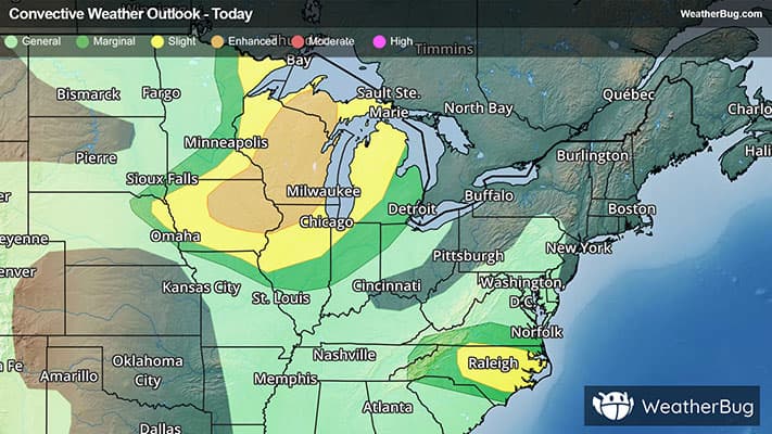
Rain showers and thunderstorms will be likely throughout the Southeast into the Tennessee Valley as well as the Great Lakes and Four Corners states. A few showers and thunderstorms cannot be ruled out across the northern Plains and Mississippi Valley.
Within all of these areas, there will be the potential for torrential downpours and/or repeated rounds of moderate to heavy rain. After several days of soggy, stormy weather, flooding concerns will be elevated, especially in the Southwest. If you are located in one of these areas, it will be crucial to pay close attention to darkening skies and rapidly changing weather conditions. Areas located near rivers, creeks and streams will be particularly concerning as well as urban, low-lying and other more flood prone spots. If you approach a flooded roadway, remember that it is always best to “Turn Around, Don’t Drown!”
As if soaking rains wasn’t enough, strong to severe thunderstorms will also be a possibility in the Great Lakes. Within thunderstorms, there will be concerns for damaging wind gusts, large hail and tornadoes. An isolated strong tornado or two could also form. A few gusty thunderstorms will also be possible in southern Virginia, much of North Carolina and far northern South Carolina.
A few spots will be free of rainy, active weather for the start of the work week. This includes the West Coast, much of the southern Plains and the Northeast into the Mid-Atlantic.
Unseasonably hot weather is in store for much of the nation’s midsection, while near to below average temperatures will be in the forecast for both coasts.
Seventies and 80s will be common across the Pacific Northwest, the tallest parts of the Mountain West and the far northern Plains into the Great Lakes, Ohio Valley, Mid-Atlantic and Northeast. Expect 90s and 100s for the interior Northwest, Great Basin, lower elevations of the Rockies and the central and southern Plains. The Tennessee Valley and Southeast will also end up with highs in the 90s. California’s Central Valley will record temperatures in the 90s and 100s, while the Desert Southwest could see highs range from 105 to 115 degrees.